alb5368504
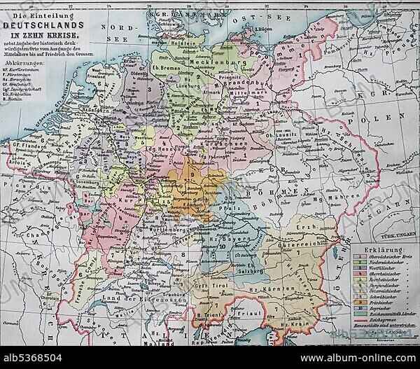
Map, the division of Germany into ten circles in the 16th century, imperial circles, historical illustration, Germany
| Partager |
|---|
 Pinterest Pinterest |
 Twitter Twitter |
 Facebook Facebook |
 Copier le lien Copier le lien |
 Email Email |
|
Ajouter à une autre Lightbox |
|
Ajouter à une autre Lightbox |


Avez-vous déjà un compte? S'identifier
Vous n'avez pas de compte ? S'inscrire
Acheter cette image.
Sélectionnez l'usage:

Légende: Voir la traduction automatique
Map, the division of Germany into ten circles in the 16th century, imperial circles, historical illustration, Germany, Europe
Map, the division of Germany into ten circles in the 16th century, imperial circles, historical illustration, Germany, Europe
Crédit: Album / ImageBroker / BAO
Autorisations: ? Autorisation de modèle: Non - ? Autorisation de propriété: Non
Questions sur les droits?
Questions sur les droits?
Taille de l'image: 4607 × 3794 px | 50.0 MB
Taille d'impression: 39.0 × 32.1 cm | 1813.8 × 1493.7 in (300 dpi)
Mots clés: 10E SIECLE • 10EME S • 16E SIECLE • 16EME S • CARTE • CARTES • CARTON • DIXIÈME SIÈCLE • GEOGRAPHIE • ILLUSTRATION • RECIT • SEIZIÈME SIÈCLE • XE SIECLE • XVIE SIECLE
