alb6176715
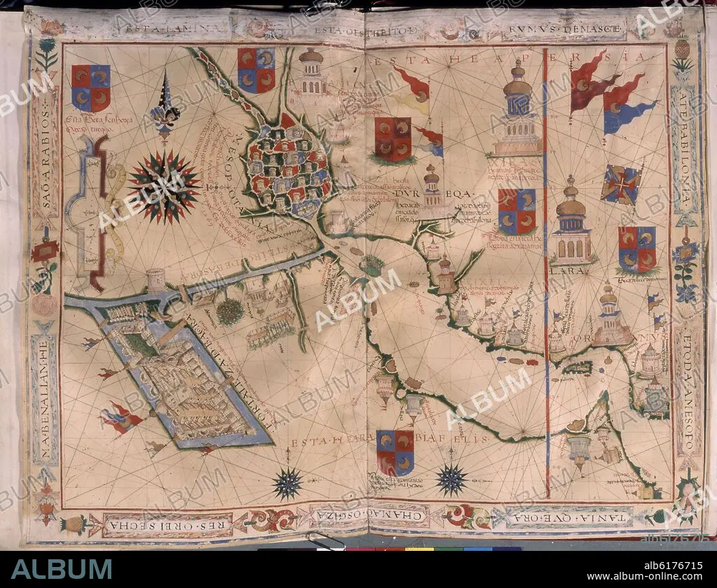
FERNAO VAZ DOURADO (1520-1580). MAPA DE MESOPOTAMIA Y EL IMPERIO PERSA - ATLAS PORTULANO - 1568 - MAR ARABIGO
| Partager |
|---|
 Pinterest Pinterest |
 Twitter Twitter |
 Facebook Facebook |
 Copier le lien Copier le lien |
 Email Email |
|
Ajouter à une autre Lightbox |
|
Ajouter à une autre Lightbox |


Avez-vous déjà un compte? S'identifier
Vous n'avez pas de compte ? S'inscrire
Acheter cette image

Auteur:
Légende:
Voir la traduction automatique
MAPA DE MESOPOTAMIA Y EL IMPERIO PERSA - ATLAS PORTULANO - 1568 - MAR ARABIGO
Emplacement:
Crédit:
Album / Oronoz
Avis de copyright :
Le droit d'auteur de l'artiste doit être liquidé si l'œuvre n'est pas dans le domaine public dans le pays pour lequel la licence est contractée.
Autorisations:
Modèle: Non - Propriété: Non
Questions sur les droits?
Questions sur les droits?
Taille de l'image:
4382 x 3362 px | 42.1 MB
Taille d'impression:
37.1 x 28.5 cm | 14.6 x 11.2 in (300 dpi)
Mots clés:
16E SIECLE • 16EME S • ANT. OR.: MESOPOTAMIE • ART PERSAN • CARTE (GEOGRAPHIE) • CARTE GEOGRAPHIQUE • CARTE MARINE • CARTE • CARTOGRAPHIE • COLLECTION PRIVÉE • CÔTE • DEMI-LUNE • DESSIN PLANS • ESPAGNE • FERNAO VAZ DOURADO (1520-1580) • GEOGRAPHIE • LITTORAL • MADRID • MARITIME • MÉSOPOTAMIE • MESOPOTAMIE, ANT. OR. • MYTHES: PERSES • NAVIGATION MARITIME ET FLUVIALE • NAVIGATION • PERSAN • PERSE • PERSES • PERSES, MYTHES • PLAN (CARTOGRAPHIE) • PLANS • SCIENCE: CARTOGRAPHIE • SEIZIÈME SIÈCLE • XVIE SIECLE
