alb3838684
Supercell with Hook Echo, Radar
| Partager |
|---|
 Pinterest Pinterest |
 Twitter Twitter |
 Facebook Facebook |
 Copier le lien Copier le lien |
 Email Email |
|
Ajouter à une autre Lightbox |
|
Ajouter à une autre Lightbox |


Avez-vous déjà un compte? S'identifier
Vous n'avez pas de compte ? S'inscrire
Acheter cette image.
Sélectionnez l'usage:

Titre:
Supercell with Hook Echo, Radar
Légende:
Voir la traduction automatique
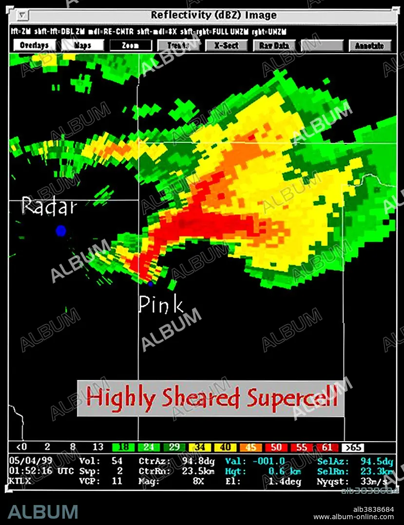
Elongated appearance of reflectivity image showing highly sheared tornadogenic supercell storm with hook echo on SW quadrant of storm. May 4, 1999, 0152 UTC. The hook echo is one of the classical hallmarks of tornado-producing supercell thunderstorms as seen on a weather radar. The echo is produced by rain, hail, or even debris being wrapped around the supercell. The National Weather Service considers the presence of a hook echo as sufficient to justify issuing a tornado warning. A supercell is a thunderstorm that is characterized by the presence of a mesocyclone: a deep, continuously-rotating updraft. For this reason, these storms are sometimes referred to as rotating thunderstorms. Of the four classifications of thunderstorms (supercell, squall line, multi-cell, and single-cell), supercells are the overall least common and have the potential to be the most severe. Supercells are often isolated from other thunderstorms, and can dominate the local climate up to 20 miles away. Supercells can occur anywhere in the world under the right pre-existing weather conditions, but they are most common in the Great Plains of the United States.
Catégorie:
TEMPS (METEOROLOGIE)
Crédit:
Album / NOAA/Science Source
Autorisations:
Taille de l'image:
2850 x 3521 px | 28.7 MB
Taille d'impression:
24.1 x 29.8 cm | 9.5 x 11.7 in (300 dpi)
Mots clés:
