alb8388764
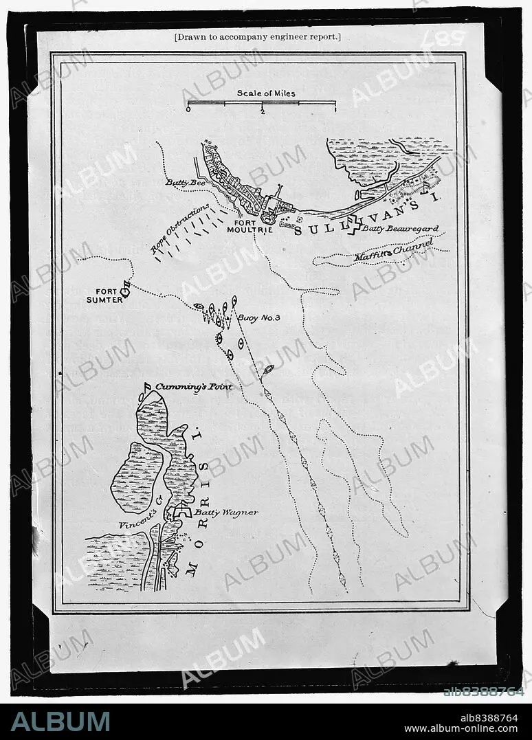
HARRIS & EWING. Map showing Fort Sumter and Fort Moultrie, between 1909 and 1914. Creator: Harris & Ewing.
| Partager |
|---|
 Pinterest Pinterest |
 Twitter Twitter |
 Facebook Facebook |
 Copier le lien Copier le lien |
 Email Email |
|
Ajouter à une autre Lightbox |
|
Ajouter à une autre Lightbox |


Avez-vous déjà un compte? S'identifier
Vous n'avez pas de compte ? S'inscrire
Acheter cette image.
Sélectionnez l'usage:

Auteur:
Titre:
Map showing Fort Sumter and Fort Moultrie, between 1909 and 1914. Creator: Harris & Ewing.
Légende:
Voir la traduction automatique
Map showing Fort Sumter and Fort Moultrie, between 1909 and 1914. 'Drawn to accompany engineer report'. Battle site, Charleston Harbour, South Carolina: Battery Bee, rope obstructions, Sullivan's Island, Maffitt's Channel, buoys, Cumming's Point, Vincent's Creek, Morris Island, Battery Wagner.
Technique/matériel:
Fotografía
Crédit:
Album / Heritage Art/Heritage Images
Autorisations:
Taille de l'image:
7741 x 10235 px | 226.7 MB
Taille d'impression:
65.5 x 86.7 cm | 25.8 x 34.1 in (300 dpi)
Mots clés:
