alb1962114
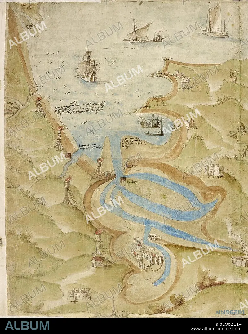
Map of Mount's Bay in Cornwall. Coastline. Sand flats and sheltered estuary and bay. Ships. . A Large colored chart of Mount’s Bay, in Cornwall. Cornwall, drawn c. 1540. A Large colored chart of Mount’s Bay, in Cornwall, drawn c. 1540. . Source: Cotton Augustus I. I 31-33 (detail). Language: English.
| Partager |
|---|
 Pinterest Pinterest |
 Twitter Twitter |
 Facebook Facebook |
 Copier le lien Copier le lien |
 Email Email |
|
Ajouter à une autre Lightbox |
|
Ajouter à une autre Lightbox |


Avez-vous déjà un compte? S'identifier
Vous n'avez pas de compte ? S'inscrire
Acheter cette image.
Sélectionnez l'usage:

Légende:
Voir la traduction automatique
Map of Mount's Bay in Cornwall. Coastline. Sand flats and sheltered estuary and bay. Ships. . A Large colored chart of Mount’s Bay, in Cornwall. Cornwall, drawn c. 1540. A Large colored chart of Mount’s Bay, in Cornwall, drawn c. 1540. . Source: Cotton Augustus I. I 31-33 (detail). Language: English.
Crédit:
Album / British Library
Autorisations:
Modèle: Non - Propriété: Non
Questions sur les droits?
Questions sur les droits?
Taille de l'image:
4866 x 6226 px | 86.7 MB
Taille d'impression:
41.2 x 52.7 cm | 16.2 x 20.8 in (300 dpi)
Mots clés:
ANGLETARRE • ANGLETERE • ANGLETERRE • BAIE • BATEAU PORT • CARTE (GEOGRAPHIE) • CARTE GEOGRAPHIQUE • CARTE • CARTOGRAPHIE • DEBARCADERE • DESSIN PLANS • EMBARCADÈRE • EUROPE • GRANDE BERTAGNE • GRANDE BRETAGNE • GRANDE-BRETAGNE • INGLATERRA • PLAN (CARTOGRAPHIE) • PLANS • PORT • PORTS • ROYAUME UNI • ROYAUME-UNI • SCIENCE: CARTOGRAPHIE • TOPOGRAPHIE
