alb9527663
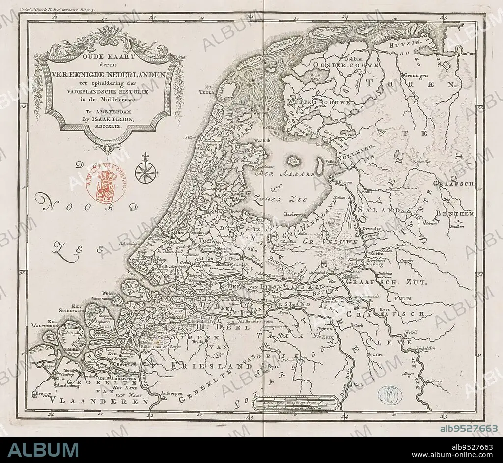
Historical map of Holland in the Middle Ages, Old map of the now united Netherlands to elucidate patriotic history in the Middle Ages (title on object), Eighteenth-century map of Holland in the Middle Ages. Title cartouche to the left. Right scale bar: German mylen of 15 in a degree, Dutch mylen or hours gaans. Degree divisions along edges., print maker: anonymous, publisher: Isaak Tirion, (mentioned on object), Amsterdam, 1749, paper, engraving, height 289 mm × width 329 mm.
| Partager |
|---|
 Pinterest Pinterest |
 Twitter Twitter |
 Facebook Facebook |
 Copier le lien Copier le lien |
 Email Email |
|
Ajouter à une autre Lightbox |
|
Ajouter à une autre Lightbox |


Avez-vous déjà un compte? S'identifier
Vous n'avez pas de compte ? S'inscrire
Acheter cette image.
Sélectionnez l'usage:

Légende:
Voir la traduction automatique
Historical map of Holland in the Middle Ages, Old map of the now united Netherlands to elucidate patriotic history in the Middle Ages (title on object), Eighteenth-century map of Holland in the Middle Ages. Title cartouche to the left. Right scale bar: German mylen of 15 in a degree, Dutch mylen or hours gaans. Degree divisions along edges., print maker: anonymous, publisher: Isaak Tirion, (mentioned on object), Amsterdam, 1749, paper, engraving, height 289 mm × width 329 mm
Crédit:
Album / quintlox
Autorisations:
Taille de l'image:
2914 x 2534 px | 21.1 MB
Taille d'impression:
24.7 x 21.5 cm | 9.7 x 8.4 in (300 dpi)
