alb1643032
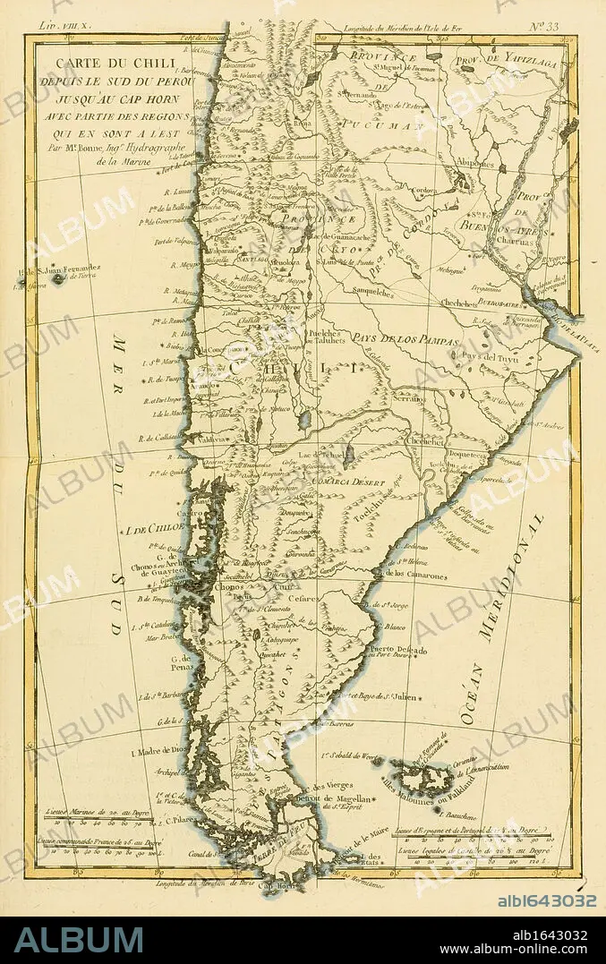
Map of Chile and southern Peru to Cape Horn, circa.1760. From 'Atlas de Toutes Les Parties Connues du Globe Terrestre ' by Cartographer Rigobert Bonne. Published Geneva circa. 1760.
| Partager |
|---|
 Pinterest Pinterest |
 Twitter Twitter |
 Facebook Facebook |
 Copier le lien Copier le lien |
 Email Email |
|
Ajouter à une autre Lightbox |
|
Ajouter à une autre Lightbox |


Avez-vous déjà un compte? S'identifier
Vous n'avez pas de compte ? S'inscrire
Acheter cette image.
Sélectionnez l'usage:

Légende: Voir la traduction automatique
Map of Chile and southern Peru to Cape Horn, circa.1760. From 'Atlas de Toutes Les Parties Connues du Globe Terrestre ' by Cartographer Rigobert Bonne. Published Geneva circa. 1760.
Map of Chile and southern Peru to Cape Horn, circa.1760. From 'Atlas de Toutes Les Parties Connues du Globe Terrestre ' by Cartographer Rigobert Bonne. Published Geneva circa. 1760.
Crédit: Album / Universal History Archive/Universal Images Group
Autorisations: ? Autorisation de modèle: Non - ? Autorisation de propriété: Non
Questions sur les droits?
Questions sur les droits?
Taille de l'image: 3497 × 5286 px | 52.9 MB
Taille d'impression: 29.6 × 44.8 cm | 1376.8 × 2081.1 in (300 dpi)
Mots clés: ASSIETTE • ASSIETTES • CARTE (GEOGRAPHIE) • CARTE GEOGRAPHIQUE • CARTE • CARTOGRAPHIE • COULEUR • DESSIN PLANS • FRAVURE • GEOGRAPHIE • GRAVURE • ILLUSTRATION • KEN • PEROU • PLAN (CARTOGRAPHIE) • PLANS • PLAT • PLATEAU (VAISSELLE) • SCIENCE: CARTOGRAPHIE • VAISSELLE ASSIETTES • VERTICALE
