alb3907897
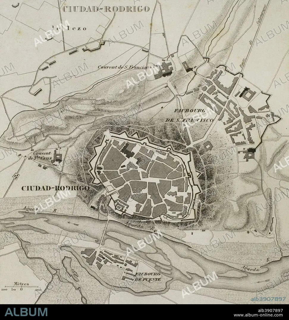
Napoleonic map. Ciudad Rodrigo (province of Salamanca, Castile and Leon, Spain). During the Peninsulan War the city was besieged twice, 1810 and 1812. Atlas de l'Histoire du Consulat et de l'Empire. History of the Consulate and the Empire of France under Napoleon by Marie Joseph Louis Adolphe Thiers (1797-1877). Drawings by Dufour, engravings by Dyonnet. Edited in Paris, 1864.
| Partager |
|---|
 Pinterest Pinterest |
 Twitter Twitter |
 Facebook Facebook |
 Copier le lien Copier le lien |
 Email Email |
|
Ajouter à une autre Lightbox |
|
Ajouter à une autre Lightbox |


Avez-vous déjà un compte? S'identifier
Vous n'avez pas de compte ? S'inscrire
Acheter cette image.
Sélectionnez l'usage:

Légende: Voir la traduction automatique
Napoleonic map. Ciudad Rodrigo (province of Salamanca, Castile and Leon, Spain). During the Peninsulan War the city was besieged twice, 1810 and 1812. Atlas de l'Histoire du Consulat et de l'Empire. History of the Consulate and the Empire of France under Napoleon by Marie Joseph Louis Adolphe Thiers (1797-1877). Drawings by Dufour, engravings by Dyonnet. Edited in Paris, 1864.
Napoleonic map. Ciudad Rodrigo (province of Salamanca, Castile and Leon, Spain). During the Peninsulan War the city was besieged twice, 1810 and 1812. Atlas de l'Histoire du Consulat et de l'Empire. History of the Consulate and the Empire of France under Napoleon by Marie Joseph Louis Adolphe Thiers (1797-1877). Drawings by Dufour, engravings by Dyonnet. Edited in Paris, 1864.
Personnalités: NAPOLÉON IER (1769-1821)
Crédit: Album / Prisma
Autorisations: ? Autorisation de modèle: Non - ? Autorisation de propriété: Non
Questions sur les droits?
Questions sur les droits?
Taille de l'image: 3543 × 3733 px | 37.8 MB
Taille d'impression: 30.0 × 31.6 cm | 1394.9 × 1469.7 in (300 dpi)
Mots clés: ANCIEN • ANTIQUE • AUTEUR • AUTEURS • CAMPAGNES NAPOLEONIENNES • CARTE (GEOGRAPHIE) • CARTE GEOGRAPHIQUE • CARTE • CARTOGRAPHIE • CIUDAD RODRIGO • CONQUETE • DESSIN PLANS • DESSIN • DESSINER • ESPAGNE • ESPAGNOL • EUROPE • EUROPÉEN • FANCE • FRANCE • FRANÇAISE • FRAVURE • GEOGRAPHIE • GRAVURE • GUERRE NAPOLEONIENNES • GUERRE SIEGE • GUERRES NAPOLEONIENNES • HISOIRE • HISTOIRE • ILLUSTRATION • MOTIF • NAPOLÉON IER • NAPOLEON, GUERRES • PLAN (CARTOGRAPHIE) • PLANS • SCIENCE: CARTOGRAPHIE • SIEGE (GUERRE) • SIEGE (MILITAIRE) • SIEGE • SUCCÈS • TECHNIQUE: DESSIN • TERRITOIRE • THIERS • TRIOMPHE • URBANISME • VICTOIRE (ALLEGORIE) • VICTOIRE • VICTOIRES • XIXE SIÈCLE
