alb9838905
NICOLAES VISSCHER. Map of North Holland, c.1700-c.1710. Creator: Nicolaes Visscher.
| Partager |
|---|
 Pinterest Pinterest |
 Twitter Twitter |
 Facebook Facebook |
 Copier le lien Copier le lien |
 Email Email |
|
Ajouter à une autre Lightbox |
|
Ajouter à une autre Lightbox |


Avez-vous déjà un compte? S'identifier
Vous n'avez pas de compte ? S'inscrire
Acheter cette image.
Sélectionnez l'usage:

Auteur:
Titre:
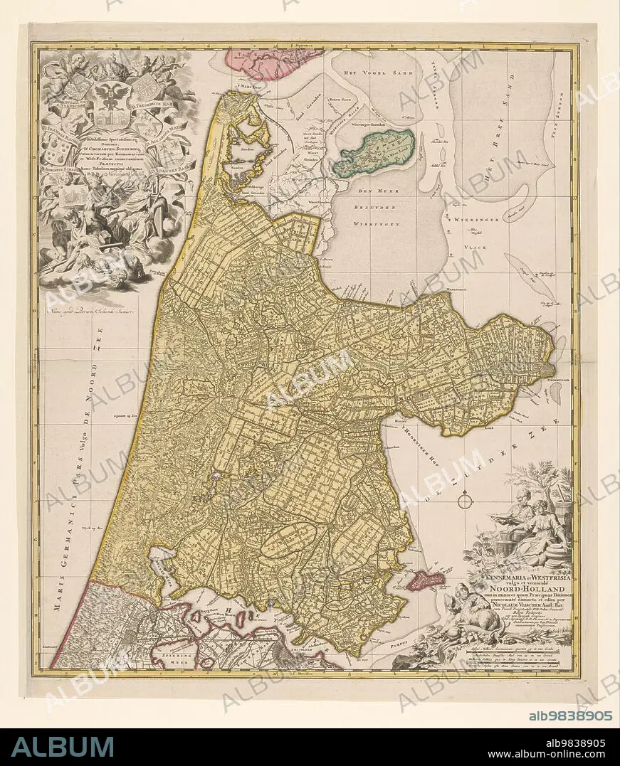
Map of North Holland, c.1700-c.1710. Creator: Nicolaes Visscher.
Légende:
Voir la traduction automatique
Map of North Holland, c.1700-c.1710. 'Kennemaria et Westfrisia vulgo et vernaculé Noord-Holland tam in minores quam Praecipuas Ditiones...'. Showing the southern tip of Texel, Wieringen, Marken and a small section of South Holland. At the bottom right scale in German and French miles (1: 150,000). At the bottom right the title, farmers with cheeses, butter and milk. At top left, dedication and putti with the imperial crown and coat of arms, allegorical figures - one holding a windmill looking at an image of a lock.
Personnalités:
Crédit:
Album / Heritage Art/Heritage Images
Autorisations:
Taille de l'image:
4748 x 5584 px | 75.9 MB
Taille d'impression:
40.2 x 47.3 cm | 15.8 x 18.6 in (300 dpi)
Mots clés:
18 18E 18EME XVIII XVIIIE XVIIIEME SIECLE • 18E SIECLE • 18EME S • ABONDANCE, CORNE D' • BANC DE SABLE • BOILLE À LAIT • CHERUBIN • CHÉRUBINS • CORNE D'ABONDANCE • CÔTE • COULEUR • DIX-HUITIÈME SIÈCLE • EMPREINTE • GENIE CIVIL • GEOGRAPHIE • ILE • ÎLES • LAIT • LITTORAL • MARITIME • NATURE • NICOLAES VISSCHER • PIETER SCHENK • POT A LAIT • PUTTO • XVIIIE SIECLE
