alb3800434
After Fall of Roman Empire, 5th Century
| Partager |
|---|
 Pinterest Pinterest |
 Twitter Twitter |
 Facebook Facebook |
 Copier le lien Copier le lien |
 Email Email |
|
Ajouter à une autre Lightbox |
|
Ajouter à une autre Lightbox |


Avez-vous déjà un compte? S'identifier
Vous n'avez pas de compte ? S'inscrire
Acheter cette image.
Sélectionnez l'usage:

Titre: After Fall of Roman Empire, 5th Century
Légende: Voir la traduction automatique
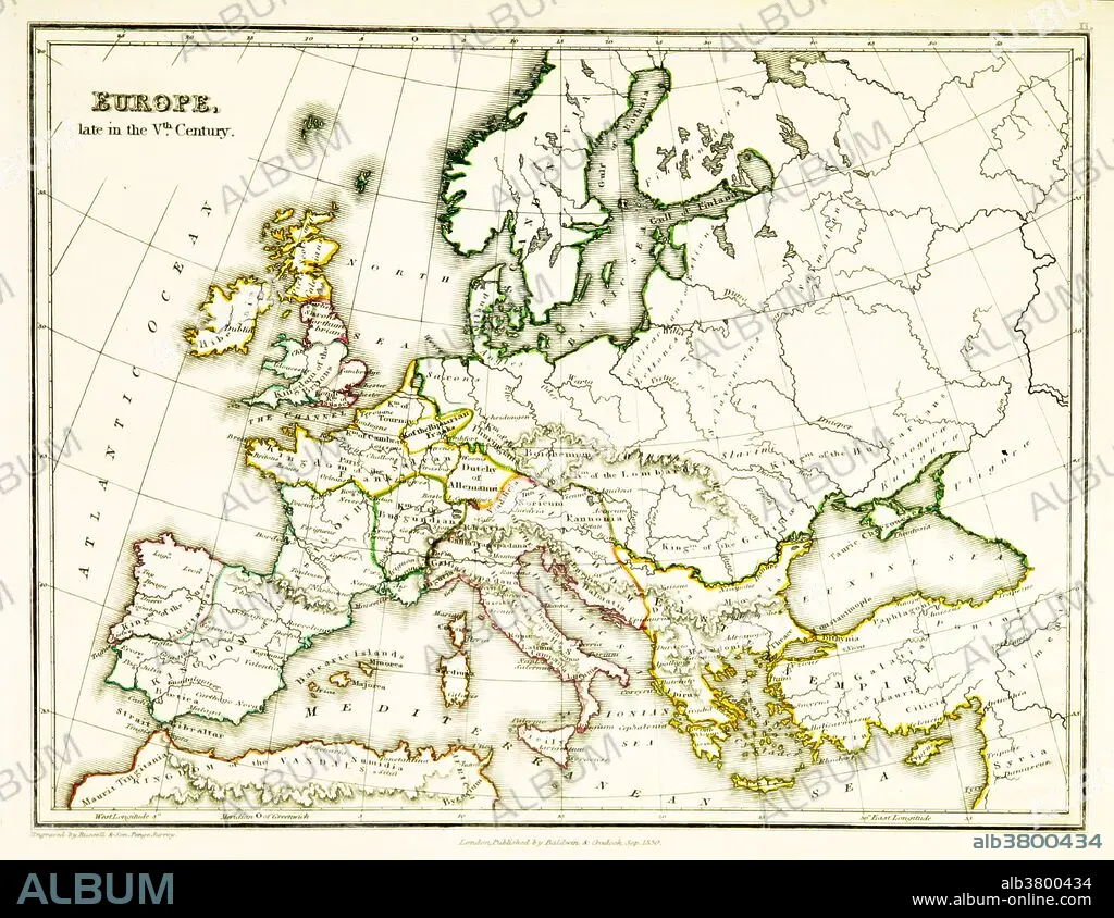
A map of Europe, showing territorial borders existing in the 5th century, after the Western Roman Empire had effectively collapsed. By 476 CE, when Odoacer deposed the Emperor Romulus, the Western Roman Empire wielded negligible military, political, or financial power and had no effective control over the scattered Western domains that could still be described as Roman. Map published in 1831.
A map of Europe, showing territorial borders existing in the 5th century, after the Western Roman Empire had effectively collapsed. By 476 CE, when Odoacer deposed the Emperor Romulus, the Western Roman Empire wielded negligible military, political, or financial power and had no effective control over the scattered Western domains that could still be described as Roman. Map published in 1831.
Crédit: Album / Science Source / British Library
Autorisations: ? Autorisation de modèle: Non - ? Autorisation de propriété: Non
Questions sur les droits?
Questions sur les droits?
Taille de l'image: 3543 × 2736 px | 27.7 MB
Taille d'impression: 30.0 × 23.2 cm | 1394.9 × 1077.2 in (300 dpi)
Mots clés: 5E SIECLE • 5EME S • CARTE • CARTOGRAPHIE • CÉLÈBRE • CELEBRITE • CINQUIÈME SIÈCLE • EUROPÉEN • GEOGRAPHIE • ILLUSTRATION • SCIENCE: CARTOGRAPHIE
