alb3547538
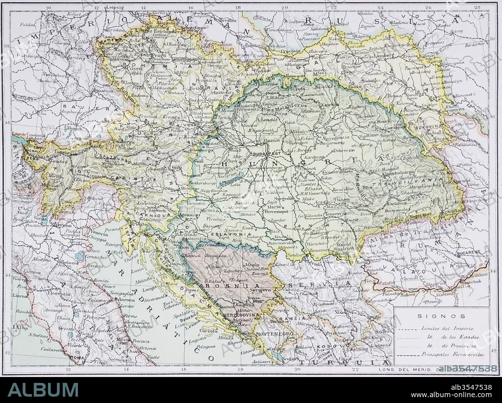
Map of the Austro-Hungarian empire at the turn of the 20th century
| Partager |
|---|
 Pinterest Pinterest |
 Twitter Twitter |
 Facebook Facebook |
 Copier le lien Copier le lien |
 Email Email |
|
Ajouter à une autre Lightbox |
|
Ajouter à une autre Lightbox |


Avez-vous déjà un compte? S'identifier
Vous n'avez pas de compte ? S'inscrire
Acheter cette image.
Sélectionnez l'usage:

Titre: Map of the Austro-Hungarian empire at the turn of the 20th century
Légende: Voir la traduction automatique
Map of the Austro-Hungarian empire at the turn of the 20th century. Map is in Spanish language. From Enciclopedia Ilustrada Seguí, published Barcelona circa 1910.
Map of the Austro-Hungarian empire at the turn of the 20th century. Map is in Spanish language. From Enciclopedia Ilustrada Seguí, published Barcelona circa 1910.
Crédit: Album / Universal Images Group / Universal History Archive
Autorisations: ? Autorisation de modèle: Non - ? Autorisation de propriété: Non
Questions sur les droits?
Questions sur les droits?
Taille de l'image: 5079 × 3815 px | 55.4 MB
Taille d'impression: 43.0 × 32.3 cm | 1999.6 × 1502.0 in (300 dpi)
Mots clés: AUTRICHE-HONGRIE • CARTE (GEOGRAPHIE) • CARTE GEOGRAPHIQUE • CARTE • DESSIN PLANS • GUERRE • HONGRIE • MONDE • PLAN (CARTOGRAPHIE) • PLANS • PREMIERE FOIS • ROYAUME • ROYAUTÉ • XXE SIECLE
