alb4062162
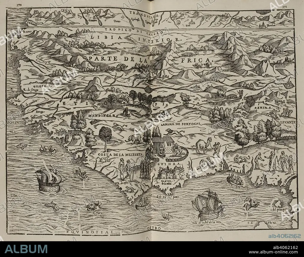
Mapa del Parte de la Frica. Coleccion de los viages y descubrimientos que hicieron por mar los Españoles desde fines del siglo XV. Madrid. Image taken from Collection of voyages and discoveries made by sea the Spaniards from the late fifteenth century. With several unpublished documents concerning the history of the Marina Castellana and the Spanish settlements in the Indies. Coordinated and illustrated by M. F. N.Published in 1825-37. Source: G.6823 370-371. Language: Spanish.
| Partager |
|---|
 Pinterest Pinterest |
 Twitter Twitter |
 Facebook Facebook |
 Copier le lien Copier le lien |
 Email Email |
|
Ajouter à une autre Lightbox |
|
Ajouter à une autre Lightbox |


Avez-vous déjà un compte? S'identifier
Vous n'avez pas de compte ? S'inscrire
Acheter cette image.
Sélectionnez l'usage:

Légende: Voir la traduction automatique
Mapa del Parte de la Frica. Coleccion de los viages y descubrimientos que hicieron por mar los Españoles desde fines del siglo XV. Madrid. Image taken from Collection of voyages and discoveries made by sea the Spaniards from the late fifteenth century. With several unpublished documents concerning the history of the Marina Castellana and the Spanish settlements in the Indies. Coordinated and illustrated by M. F. N.Published in 1825-37. Source: G.6823 370-371. Language: Spanish.
Mapa del Parte de la Frica. Coleccion de los viages y descubrimientos que hicieron por mar los Españoles desde fines del siglo XV. Madrid. Image taken from Collection of voyages and discoveries made by sea the Spaniards from the late fifteenth century. With several unpublished documents concerning the history of the Marina Castellana and the Spanish settlements in the Indies. Coordinated and illustrated by M. F. N.Published in 1825-37. Source: G.6823 370-371. Language: Spanish.
Crédit: Album / British Library
Autorisations: ? Autorisation de modèle: Non - ? Autorisation de propriété: Non
Questions sur les droits?
Questions sur les droits?
Taille de l'image: 6008 × 4760 px | 81.8 MB
Taille d'impression: 50.9 × 40.3 cm | 2365.4 × 1874.0 in (300 dpi)
Mots clés: AFRIQUE DU SUD • AFRIQUE • CARTE (GEOGRAPHIE) • CARTE GEOGRAPHIQUE • CARTE • DESSIN PLANS • PLAN (CARTOGRAPHIE) • PLANS
