alb5385829
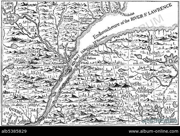
Map of 1730, the St. Lawrence river in Quebec, Canada, North America.
| Partager |
|---|
 Pinterest Pinterest |
 Twitter Twitter |
 Facebook Facebook |
 Copier le lien Copier le lien |
 Email Email |
|
Ajouter à une autre Lightbox |
|
Ajouter à une autre Lightbox |


Avez-vous déjà un compte? S'identifier
Vous n'avez pas de compte ? S'inscrire
Acheter cette image.
Sélectionnez l'usage:

Légende:
Voir la traduction automatique
Map of 1730, the St. Lawrence river in Quebec, Canada, North America
Crédit:
Album / ImageBroker / H.-D. Falkenstein
Autorisations:
Taille de l'image:
4991 x 3511 px | 50.1 MB
Taille d'impression:
42.3 x 29.7 cm | 16.6 x 11.7 in (300 dpi)
Mots clés:
AMÉRICAIN • AMERIQUE • AMERIQUE, CONTINENT • CANADA • CARTE • CARTES • CARTON • COLONIALISME • CONTINENT AMERIQUE • GEOGRAPHIE
