alb4088374
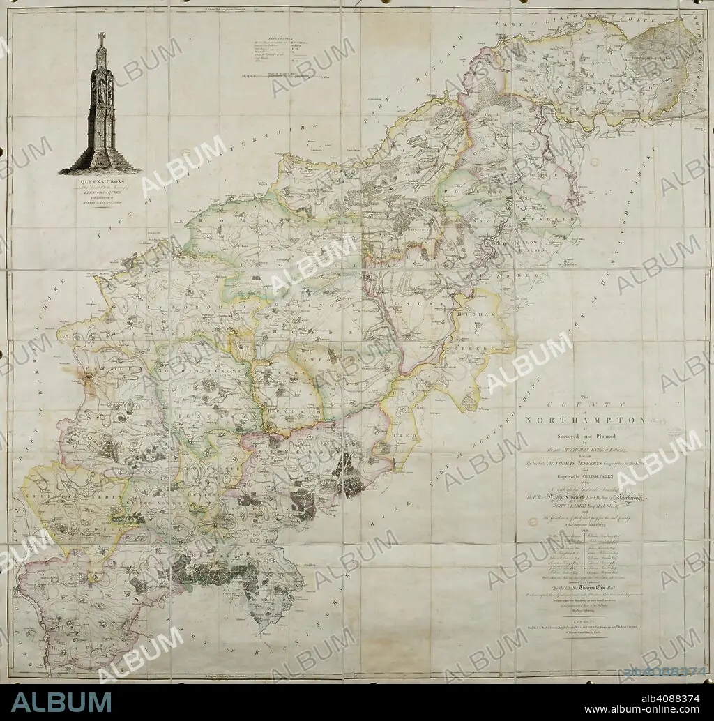
THOMAS JEFFREYS et W FADEN. 18th century map of the county of Northamptonshire. . The County of Northamptonshire, as surveyed and planned by the late T. Eyre, revised by the late T. Jefferys, and engraved by W. Faden. London, 1779. Source: Maps*4420.(3).
| Partager |
|---|
 Pinterest Pinterest |
 Twitter Twitter |
 Facebook Facebook |
 Copier le lien Copier le lien |
 Email Email |
|
Ajouter à une autre Lightbox |
|
Ajouter à une autre Lightbox |


Avez-vous déjà un compte? S'identifier
Vous n'avez pas de compte ? S'inscrire
Acheter cette image.
Sélectionnez l'usage:

Auteur: THOMAS JEFFREYS • W FADEN
Légende: Voir la traduction automatique
18th century map of the county of Northamptonshire. . The County of Northamptonshire, as surveyed and planned by the late T. Eyre, revised by the late T. Jefferys, and engraved by W. Faden. London, 1779. Source: Maps*4420.(3).
18th century map of the county of Northamptonshire. . The County of Northamptonshire, as surveyed and planned by the late T. Eyre, revised by the late T. Jefferys, and engraved by W. Faden. London, 1779. Source: Maps*4420.(3).
Crédit: Album / British Library
Autorisations: ? Autorisation de modèle: Non - ? Autorisation de propriété: Non
Questions sur les droits?
Questions sur les droits?
Taille de l'image: 6647 × 6367 px | 121.1 MB
Taille d'impression: 56.3 × 53.9 cm | 2616.9 × 2506.7 in (300 dpi)
Mots clés: 18 18E 18EME XVIII XVIIIE XVIIIEME SIECLE • 18E SIECLE • 18EME S • ANGLETARRE • ANGLETERE • ANGLETERRE • CARTE (GEOGRAPHIE) • CARTE GEOGRAPHIQUE • CARTE • CARTOGRAPHIE • COULEUR • COULEURS • DESSIN PLANS • DIX-HUITIÈME SIÈCLE • EUROPE • FADEN, W • GRANDE BERTAGNE • GRANDE BRETAGNE • GRANDE-BRETAGNE • INGLATERRA • JEFFREYS, THOMAS • PLAN (CARTOGRAPHIE) • PLANS • ROYAUME UNI • ROYAUME-UNI • SCIENCE: CARTOGRAPHIE • XVIIIE SIECLE
