alb9231631
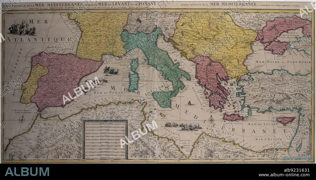
Marine chart of the eastern part of the Mediterranean Sea with the entire African coast..., 17th cen Creator: Sanson, Nicolás (1600-1667) .
| Partager |
|---|
 Pinterest Pinterest |
 Twitter Twitter |
 Facebook Facebook |
 Copier le lien Copier le lien |
 Email Email |
|
Ajouter à une autre Lightbox |
|
Ajouter à une autre Lightbox |


Avez-vous déjà un compte? S'identifier
Vous n'avez pas de compte ? S'inscrire
Acheter cette image.
Sélectionnez l'usage:

Titre:
Marine chart of the eastern part of the Mediterranean Sea with the entire African coast..., 17th cen Creator: Sanson, Nicolás (1600-1667) .
Légende:
Voir la traduction automatique
Marine chart of the eastern part of the Mediterranean Sea with the entire African coast to Egypt and the Red Sea and part of the Black Sea, 17th century. Edited in Amsterdam by Pierre Mortier.
Crédit:
Album / Arxiu Delstres - Index/Heritage Images
Autorisations:
Modèle: Non - Propriété: Non
Questions sur les droits?
Questions sur les droits?
Taille de l'image:
7200 x 3718 px | 76.6 MB
Taille d'impression:
61.0 x 31.5 cm | 24.0 x 12.4 in (300 dpi)
