alb4632971
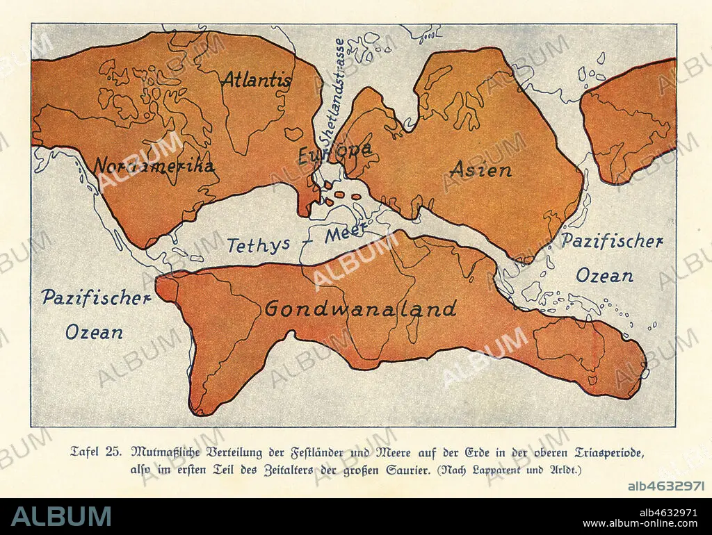
Map of the continents and seas in the Upper Triassic period. North America, Atlantis, Europe, Asia, Gondwanaland. Colour print after an illustration from Wilhelm Bolsches Das Leben der Urwelt, Prehistoric Life, Georg Dollheimer, Leipzig, 1932.
| Partager |
|---|
 Pinterest Pinterest |
 Twitter Twitter |
 Facebook Facebook |
 Copier le lien Copier le lien |
 Email Email |
|
Ajouter à une autre Lightbox |
|
Ajouter à une autre Lightbox |


Avez-vous déjà un compte? S'identifier
Vous n'avez pas de compte ? S'inscrire
Acheter cette image.
Sélectionnez l'usage:

Légende: Voir la traduction automatique
Map of the continents and seas in the Upper Triassic period. North America, Atlantis, Europe, Asia, Gondwanaland. Colour print after an illustration from Wilhelm Bolsches Das Leben der Urwelt, Prehistoric Life, Georg Dollheimer, Leipzig, 1932.
Map of the continents and seas in the Upper Triassic period. North America, Atlantis, Europe, Asia, Gondwanaland. Colour print after an illustration from Wilhelm Bolsches Das Leben der Urwelt, Prehistoric Life, Georg Dollheimer, Leipzig, 1932.
Crédit: Album / Florilegius
Autorisations: ? Autorisation de modèle: Non - ? Autorisation de propriété: Non
Questions sur les droits?
Questions sur les droits?
Taille de l'image: 6581 × 4605 px | 86.7 MB
Taille d'impression: 55.7 × 39.0 cm | 2590.9 × 1813.0 in (300 dpi)
Mots clés: ASIE • ASIE, CONTINENT • CARTE (GEOGRAPHIE) • CARTE GEOGRAPHIQUE • CARTE • CONTINENT ASIE • DESSIN PLANS • EUROPE • ILLUSTRATION • MER • OCEAN • PALEONTOLOGIE • PAYSAGE MARITIME • PLAN (CARTOGRAPHIE) • PLANS • ZOOLOGIE
