alb4542016
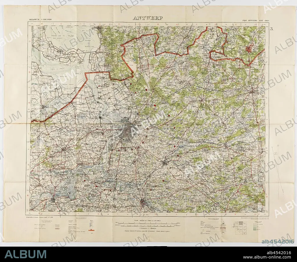
Map - Military, Belgium, Antwerp 3, Scale 1:100,000, 1912, Military map, Belgium, Antwerp, 3 scale 1:100,000. Labelled 'Georgaphical Section General Staff no. 2364', the map was photo-etched at the Ordnance Survey Office, Southampton, England, in 1911, and was drawn and printed at the War Office in 1912. The map was used by Captain Morris Lewis during World War I. Captain Lewis, 44th Battalion, Third Division, First AIF, was born in Wales in 1892 of.
| Partager |
|---|
 Pinterest Pinterest |
 Twitter Twitter |
 Facebook Facebook |
 Copier le lien Copier le lien |
 Email Email |
|
Ajouter à une autre Lightbox |
|
Ajouter à une autre Lightbox |


Avez-vous déjà un compte? S'identifier
Vous n'avez pas de compte ? S'inscrire
Acheter cette image.
Sélectionnez l'usage:

Légende:
Voir la traduction automatique
Map - Military, Belgium, Antwerp 3, Scale 1:100,000, 1912, Military map, Belgium, Antwerp, 3 scale 1:100,000. Labelled 'Georgaphical Section General Staff no. 2364', the map was photo-etched at the Ordnance Survey Office, Southampton, England, in 1911, and was drawn and printed at the War Office in 1912. The map was used by Captain Morris Lewis during World War I. Captain Lewis, 44th Battalion, Third Division, First AIF, was born in Wales in 1892 of
Crédit:
Album / quintlox
Autorisations:
Taille de l'image:
3900 x 3238 px | 36.1 MB
Taille d'impression:
33.0 x 27.4 cm | 13.0 x 10.8 in (300 dpi)
Mots clés:
ANGLETARRE • ANGLETERE • ANGLETERRE • ANVERS • BELGIQUE • CARTE (GEOGRAPHIE) • CARTE GEOGRAPHIQUE • CARTE • DESSIN PLANS • GRANDE BERTAGNE • GRANDE BRETAGNE • GRANDE GUERRE • GRANDE-BRETAGNE • GUERRE 14-18 • GUERRE 1914-1918 • GUERRE MONDIALE I • INGLATERRA • PLAN (CARTOGRAPHIE) • PLANS • PREMIERE GUERRE MONDIALE (1914-1918) • PREMIERE GUERRE MONDIALE • ROYAUME UNI • ROYAUME-UNI
