alb5409621
Slave Trade of Africa Map,1899
| Partager |
|---|
 Pinterest Pinterest |
 Twitter Twitter |
 Facebook Facebook |
 Copier le lien Copier le lien |
 Email Email |
|
Ajouter à une autre Lightbox |
|
Ajouter à une autre Lightbox |


Avez-vous déjà un compte? S'identifier
Vous n'avez pas de compte ? S'inscrire
Acheter cette image.
Sélectionnez l'usage:

Titre: Slave Trade of Africa Map,1899
Légende: Voir la traduction automatique
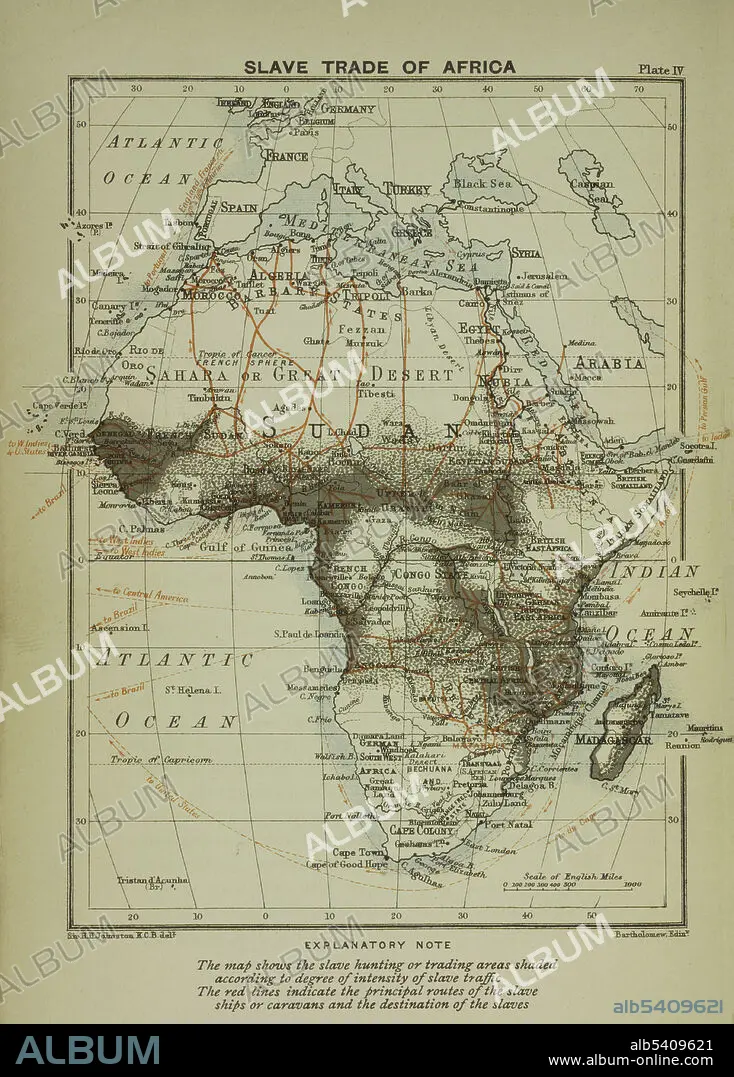
A map of the slave trade in Africa that shows the regions of most intense activity. The map shows the slave hunting or trading areas shaded according to degree of intensity of slave traffic. The red lines indicate the principal routes of the slave ships or caravans and the destination of the slaves.
A map of the slave trade in Africa that shows the regions of most intense activity. The map shows the slave hunting or trading areas shaded according to degree of intensity of slave traffic. The red lines indicate the principal routes of the slave ships or caravans and the destination of the slaves.
Crédit: Album / NYPL/Science Source
Autorisations: ? Autorisation de modèle: Non - ? Autorisation de propriété: Non
Questions sur les droits?
Questions sur les droits?
Taille de l'image: 3441 × 4800 px | 47.3 MB
Taille d'impression: 29.1 × 40.6 cm | 1354.7 × 1889.8 in (300 dpi)
Mots clés: AFRIQUE • CARTE • CARTOGRAPHIE • ESCLAVAGE • SCIENCE: CARTOGRAPHIE
