alb9020618
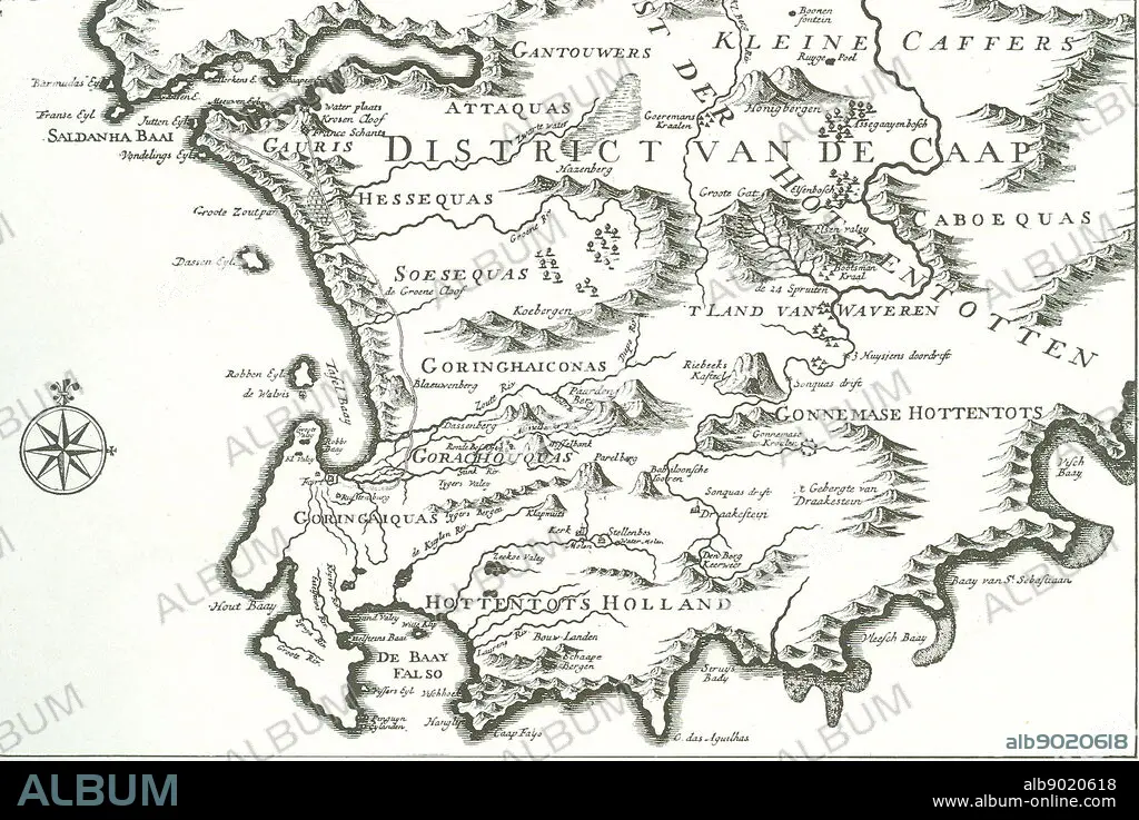
District of the Cape' (The Good Hope)' - map of a portion of the present Cape Colony. The former ship's doctor Johan van Riebeek landed in Table Bay in 1652 and built the beginning of a Dutch settlement in South Africa.
| Partager |
|---|
 Pinterest Pinterest |
 Twitter Twitter |
 Facebook Facebook |
 Copier le lien Copier le lien |
 Email Email |
|
Ajouter à une autre Lightbox |
|
Ajouter à une autre Lightbox |


Avez-vous déjà un compte? S'identifier
Vous n'avez pas de compte ? S'inscrire
Acheter cette image.
Sélectionnez l'usage:

Légende:
Voir la traduction automatique
District of the Cape' (The Good Hope)' - map of a portion of the present Cape Colony. The former ship's doctor Johan van Riebeek landed in Table Bay in 1652 and built the beginning of a Dutch settlement in South Africa.
Crédit:
Album / World History Archive
Autorisations:
Modèle: Non - Propriété: Non
Questions sur les droits?
Questions sur les droits?
Taille de l'image:
3700 x 2470 px | 26.1 MB
Taille d'impression:
31.3 x 20.9 cm | 12.3 x 8.2 in (300 dpi)
