alb4064224
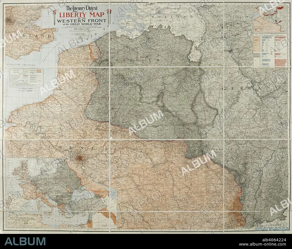
A map of the 'Western front' during the First World War. It covers mostly France, Belgium, Holland and Germany. The Literary Digest Liberty Map of the Western Front of the Great World War ... with complete index. Natural scale, 1 : 500,000. New York : Funk & Wagnalls, 1918. Source: Maps.14317.(90).
| Partager |
|---|
 Pinterest Pinterest |
 Twitter Twitter |
 Facebook Facebook |
 Copier le lien Copier le lien |
 Email Email |
|
Ajouter à une autre Lightbox |
|
Ajouter à une autre Lightbox |


Avez-vous déjà un compte? S'identifier
Vous n'avez pas de compte ? S'inscrire
Acheter cette image.
Sélectionnez l'usage:

Légende:
Voir la traduction automatique
A map of the 'Western front' during the First World War. It covers mostly France, Belgium, Holland and Germany. The Literary Digest Liberty Map of the Western Front of the Great World War ... with complete index. Natural scale, 1 : 500,000. New York : Funk & Wagnalls, 1918. Source: Maps.14317.(90).
Crédit:
Album / British Library
Autorisations:
Modèle: Non - Propriété: Non
Questions sur les droits?
Questions sur les droits?
Taille de l'image:
7526 x 6037 px | 130.0 MB
Taille d'impression:
63.7 x 51.1 cm | 25.1 x 20.1 in (300 dpi)
Mots clés:
CARTE (GEOGRAPHIE) • CARTE GEOGRAPHIQUE • CARTE • CARTOGRAPHIE • COULEUR • COULEURS • DESSIN PLANS • ÉVÉNEMENT • GRANDE GUERRE • GUERRE 14-18 • GUERRE 1914-1918 • GUERRE MONDIALE I • GUERRE • PLAN (CARTOGRAPHIE) • PLANS • PREMIERE GUERRE MONDIALE (1914-1918) • PREMIERE GUERRE MONDIALE • SCIENCE: CARTOGRAPHIE • XXE SIECLE
