alb5528982
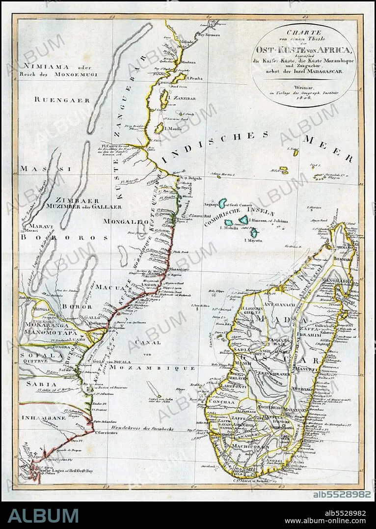
East Africa / Indian Ocean: Map of East Africa with Mozambique, Zanzibar and Madagascar. Weimar Geographische Institut,1806.
| Partager |
|---|
 Pinterest Pinterest |
 Twitter Twitter |
 Facebook Facebook |
 Copier le lien Copier le lien |
 Email Email |
|
Ajouter à une autre Lightbox |
|
Ajouter à une autre Lightbox |


Avez-vous déjà un compte? S'identifier
Vous n'avez pas de compte ? S'inscrire
Acheter cette image.
Sélectionnez l'usage:

Titre: East Africa / Indian Ocean: Map of East Africa with Mozambique, Zanzibar and Madagascar. Weimar Geographische Institut,1806.
Légende: Voir la traduction automatique
The Swahili Coast refers to the coast or coastal area of East Africa inhabited by the Swahili people, mainly Kenya, Tanzania, and north Mozambique. The term may also include the islands such as Zanzibar, Pate or Comoros which lie off the Swahili Coast. The Swahili Coast has a distinct culture, religion and geography.
The Swahili Coast refers to the coast or coastal area of East Africa inhabited by the Swahili people, mainly Kenya, Tanzania, and north Mozambique. The term may also include the islands such as Zanzibar, Pate or Comoros which lie off the Swahili Coast. The Swahili Coast has a distinct culture, religion and geography.
Crédit: Album / Pictures from History/Universal Images Group
Autorisations: ? Autorisation de modèle: Non - ? Autorisation de propriété: Non
Questions sur les droits?
Questions sur les droits?
Taille de l'image: 3600 × 4814 px | 49.6 MB
Taille d'impression: 30.5 × 40.8 cm | 1417.3 × 1895.3 in (300 dpi)
Mots clés: AFRICAIN • AFRICAINE • AFRIQUE • BAGAMOYO • CARTE (GEOGRAPHIE) • CARTE GEOGRAPHIQUE • CARTE • CARTOGRAPHIE • DESSIN PLANS • HISOIRE • HISTOIRE • ISLAM • ISLMAM • MUSULMAN • MUSULMANE • MUSUSLMAN • PLAN (CARTOGRAPHIE) • PLANS • RELIGION • SCIENCE: CARTOGRAPHIE • SWAHILIS • TANZANIE • ZANZIBAR
