alb12757942
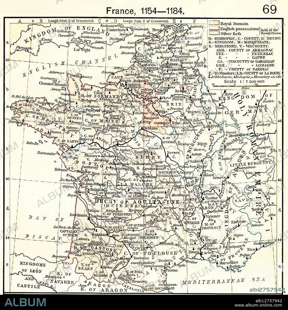
Map showing Aquitaine and Angevin English territories.
| Partager |
|---|
 Pinterest Pinterest |
 Twitter Twitter |
 Facebook Facebook |
 Copier le lien Copier le lien |
 Email Email |
|
Ajouter à une autre Lightbox |
|
Ajouter à une autre Lightbox |


Avez-vous déjà un compte? S'identifier
Vous n'avez pas de compte ? S'inscrire
Acheter cette image.
Sélectionnez l'usage:

Titre:
Map showing Aquitaine and Angevin English territories.
Légende:
Voir la traduction automatique
France, 1154-1184 Map showing Aquitaine and Angevin English territories.
Crédit:
Album / Universal History Archive/Universal Images Group
Autorisations:
Taille de l'image:
4000 x 4089 px | 46.8 MB
Taille d'impression:
33.9 x 34.6 cm | 13.3 x 13.6 in (300 dpi)
Mots clés:
ANGALIS • ANGLAIS • ANGLAISE • CARTE (GEOGRAPHIE) • CARTE GEOGRAPHIQUE • CARTE • CONQUETE • DESSIN PLANS • DUC • EUROPE • FRANCE • GEOGRAPHIE • HISOIRE • HISTOIRE • MONARCHIE • PLAN (CARTOGRAPHIE) • PLANS • PLOITICIEN • POLITICIEN • REINE • REINES • ROI • SUCCÈS • TERROIR • TRIOMPHE • VICTOIRE (ALLEGORIE) • VICTOIRE • VICTOIRES
