alb4284910
Map of the Battle of Verdun
| Partager |
|---|
 Pinterest Pinterest |
 Twitter Twitter |
 Facebook Facebook |
 Copier le lien Copier le lien |
 Email Email |
|
Ajouter à une autre Lightbox |
|
Ajouter à une autre Lightbox |


Avez-vous déjà un compte? S'identifier
Vous n'avez pas de compte ? S'inscrire
Acheter cette image.
Sélectionnez l'usage:

Titre:
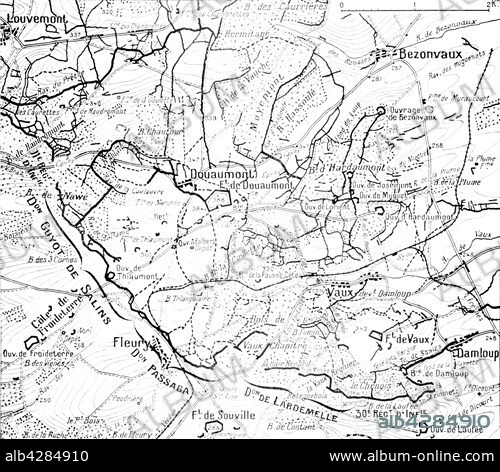
Map of the Battle of Verdun
Légende:
Voir la traduction automatique
First World War.. Map of positions at the time of the Battle of Verdun and the land around the forsts of Douaumont and Vaux with an indication of attacking front lines of the French divisions on 24th October 1916.
Crédit:
Album / Photo12/Archives Snark
Autorisations:
Taille de l'image:
4862 x 4272 px | 59.4 MB
Taille d'impression:
41.2 x 36.2 cm | 16.2 x 14.2 in (300 dpi)
