alb5271642
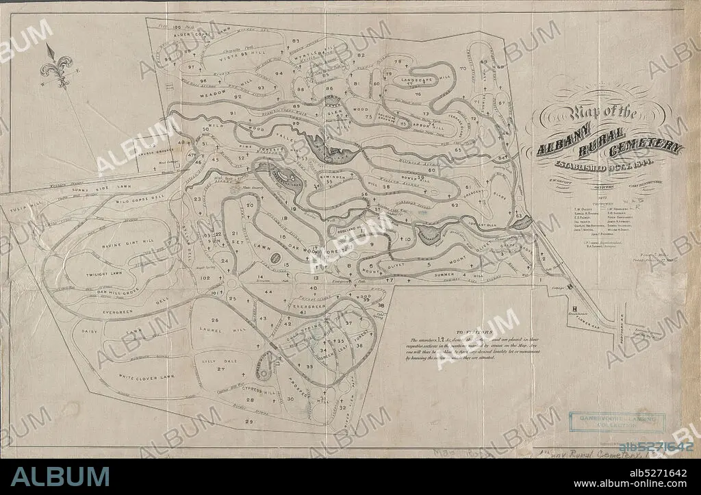
Map of the Albany Rural Cemetery, established, Oct. 7 1844, cartographic, Maps, 1871, Van Benthuysen, C. (Charles), 1817-1881, Thomas, J. P., Thomas, B. A., Gavit, John E., 1817-1874.
| Partager |
|---|
 Pinterest Pinterest |
 Twitter Twitter |
 Facebook Facebook |
 Copier le lien Copier le lien |
 Email Email |
|
Ajouter à une autre Lightbox |
|
Ajouter à une autre Lightbox |


Avez-vous déjà un compte? S'identifier
Vous n'avez pas de compte ? S'inscrire
Acheter cette image.
Sélectionnez l'usage:

Légende:
Voir la traduction automatique
Map of the Albany Rural Cemetery, established, Oct. 7 1844, cartographic, Maps, 1871, Van Benthuysen, C. (Charles), 1817-1881, Thomas, J. P., Thomas, B. A., Gavit, John E., 1817-1874
Crédit:
Album / quintlox
Autorisations:
Modèle: Non - Propriété: Non
Questions sur les droits?
Questions sur les droits?
Taille de l'image:
6300 x 4119 px | 74.2 MB
Taille d'impression:
53.3 x 34.9 cm | 21.0 x 13.7 in (300 dpi)
Mots clés:
