alb9331249
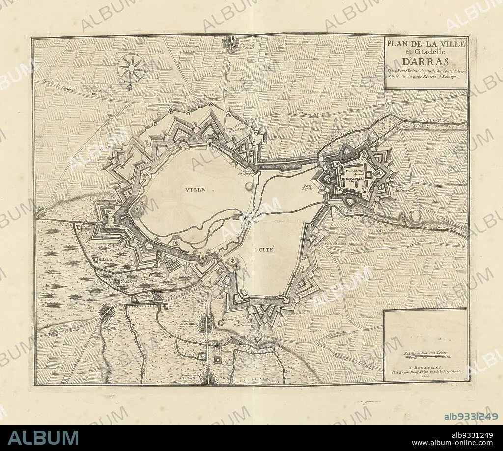
Map of Arras, 1710, Plan de la Ville et Citadelle d'Arras (title on object), Map of Arras, 1710. Part of a bundled collection of plans of battles and cities renowned in the War of the Spanish Succession., print maker: Jacobus Harrewijn (attributed to), publisher: Eugene Henry Fricx (mentioned on object), Brussels, 1710, paper, etching, height 398 mm × width 500 mm.
| Partager |
|---|
 Pinterest Pinterest |
 Twitter Twitter |
 Facebook Facebook |
 Copier le lien Copier le lien |
 Email Email |
|
Ajouter à une autre Lightbox |
|
Ajouter à une autre Lightbox |


Avez-vous déjà un compte? S'identifier
Vous n'avez pas de compte ? S'inscrire
Acheter cette image.
Sélectionnez l'usage:

Légende:
Voir la traduction automatique
Map of Arras, 1710, Plan de la Ville et Citadelle d'Arras (title on object), Map of Arras, 1710. Part of a bundled collection of plans of battles and cities renowned in the War of the Spanish Succession., print maker: Jacobus Harrewijn (attributed to), publisher: Eugene Henry Fricx (mentioned on object), Brussels, 1710, paper, etching, height 398 mm × width 500 mm
Personnalités:
Crédit:
Album / quintlox
Autorisations:
Modèle: Non - Propriété: Non
Questions sur les droits?
Questions sur les droits?
Taille de l'image:
4444 x 3748 px | 47.7 MB
Taille d'impression:
37.6 x 31.7 cm | 14.8 x 12.5 in (300 dpi)
Mots clés:
