alb3124106
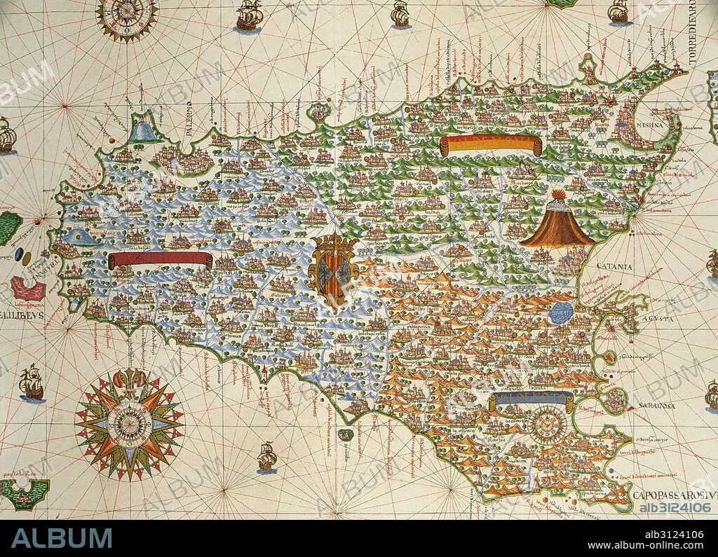
Island of Sicily. Portolan chart by Joan Martines, Spanish cartographer of the Majorcan cartographic school (16th century). Manuscript of 19 double-folio maps. Messina, Sicily, 1587. National Library, Madrid, Spain.
| Partager |
|---|
 Pinterest Pinterest |
 Twitter Twitter |
 Facebook Facebook |
 Copier le lien Copier le lien |
 Email Email |
|
Ajouter à une autre Lightbox |
|
Ajouter à une autre Lightbox |


Avez-vous déjà un compte? S'identifier
Vous n'avez pas de compte ? S'inscrire
Acheter cette image.
Sélectionnez l'usage:

Légende: Voir la traduction automatique
Island of Sicily. Portolan chart by Joan Martines, Spanish cartographer of the Majorcan cartographic school (16th century). Manuscript of 19 double-folio maps. Messina, Sicily, 1587. National Library, Madrid, Spain.
Island of Sicily. Portolan chart by Joan Martines, Spanish cartographer of the Majorcan cartographic school (16th century). Manuscript of 19 double-folio maps. Messina, Sicily, 1587. National Library, Madrid, Spain.
Crédit: Album / Prisma
Autorisations: ? Autorisation de modèle: Non - ? Autorisation de propriété: Non
Questions sur les droits?
Questions sur les droits?
Taille de l'image: 4961 × 3595 px | 51.0 MB
Taille d'impression: 42.0 × 30.4 cm | 1953.1 × 1415.4 in (300 dpi)
Mots clés: 16E SIECLE • 16EME S • CARTE (GEOGRAPHIE) • CARTE GEOGRAPHIQUE • CARTE MARINE • CARTE • CARTOGRAPHE • CARTOGRAPHIE • DESSIN PLANS • EUROPE • FLEUR: ROSE • GEOGRAPHIE • HISOIRE • HISTOIRE • ILE • ÎLES • MEDITERRANEAN • MÉDITERRANÉE • MÉDITERRANNÉE • NAVIGATION MARITIME ET FLUVIALE • NAVIGATION • PLAN (CARTOGRAPHIE) • PLANS • PORTULAN • ROSE DES VENTS • ROSE • SCIENCE: CARTOGRAPHIE • SEIZIÈME SIÈCLE • SICILE • XVIE SIECLE
