alb4057434
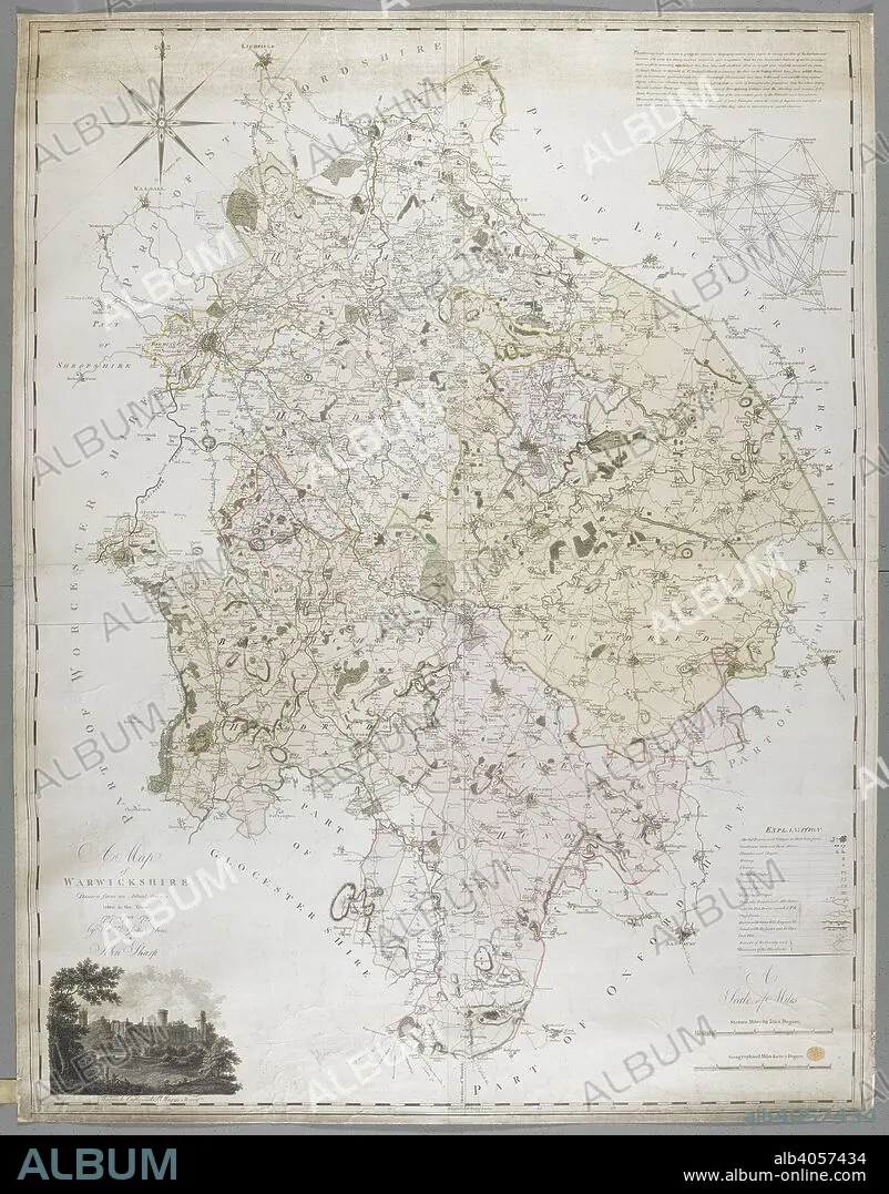
WILLIAM YATES AND SONS. A Map of Warwickshire, 1787. A Map of Warwickshire, drawn from an actual survey taken in the years 1787, 8, 9 by W. Yates and Sons. Warwick, 1793. Source: Maps K.Top.42.76.11.Tab.
| Partager |
|---|
 Pinterest Pinterest |
 Twitter Twitter |
 Facebook Facebook |
 Copier le lien Copier le lien |
 Email Email |
|
Ajouter à une autre Lightbox |
|
Ajouter à une autre Lightbox |


Avez-vous déjà un compte? S'identifier
Vous n'avez pas de compte ? S'inscrire
Acheter cette image

Auteur:
Légende:
Voir la traduction automatique
A Map of Warwickshire, 1787. A Map of Warwickshire, drawn from an actual survey taken in the years 1787, 8, 9 by W. Yates and Sons. Warwick, 1793. Source: Maps K.Top.42.76.11.Tab.
Crédit:
Album / British Library
Autorisations:
Modèle: Non - Propriété: Non
Questions sur les droits?
Questions sur les droits?
Taille de l'image:
8296 x 10595 px | 251.5 MB
Taille d'impression:
70.2 x 89.7 cm | 27.7 x 35.3 in (300 dpi)
Mots clés:
18 18E 18EME XVIII XVIIIE XVIIIEME SIECLE • 18E SIECLE • 18EME S • ANGLETARRE • ANGLETERE • ANGLETERRE • CARTE (GEOGRAPHIE) • CARTE GEOGRAPHIQUE • CARTE • CARTOGRAPHIE • COULEUR • COULEURS • DESSIN PLANS • DIX-HUITIÈME SIÈCLE • EUROPE • GRANDE BERTAGNE • GRANDE BRETAGNE • GRANDE-BRETAGNE • INGLATERRA • PLAN (CARTOGRAPHIE) • PLANS • ROYAUME UNI • ROYAUME-UNI • SCIENCE: CARTOGRAPHIE • XVIIIE SIECLE • YATES AND SONS, WILLIAM
