alb9840143
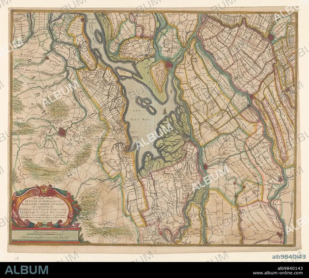
BALTHASAR FLORISZ. VAN BERCKENRODE. Map of parts of North Brabant, South Holland and Gelderland, 1629. Creator: Balthasar Florisz. van Berckenrode.
| Partager |
|---|
 Pinterest Pinterest |
 Twitter Twitter |
 Facebook Facebook |
 Copier le lien Copier le lien |
 Email Email |
|
Ajouter à une autre Lightbox |
|
Ajouter à une autre Lightbox |


Avez-vous déjà un compte? S'identifier
Vous n'avez pas de compte ? S'inscrire
Acheter cette image.
Sélectionnez l'usage:

Titre:
Map of parts of North Brabant, South Holland and Gelderland, 1629. Creator: Balthasar Florisz. van Berckenrode.
Légende:
Voir la traduction automatique
Map of parts of North Brabant, South Holland and Gelderland, 1629. The surroundings of the Bies Bos, sailing ship. Bottom left a cartouche with the title with the scale in German miles (1: 100,000).
Technique/matériel:
EAU-FORTE
Crédit:
Album / Heritage Art/Heritage Images
Autorisations:
Taille de l'image:
5056 x 4284 px | 62.0 MB
Taille d'impression:
42.8 x 36.3 cm | 16.9 x 14.3 in (300 dpi)
Mots clés:
