alb3549034
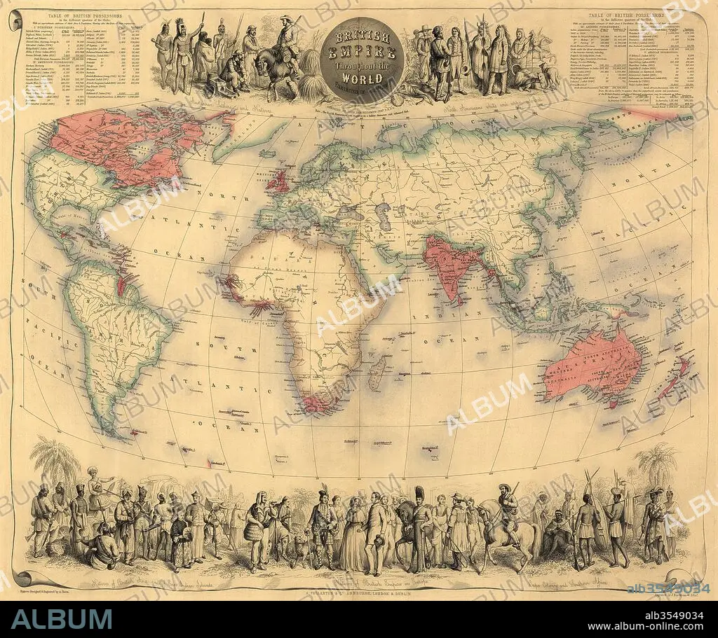
Map of the world circa 1870 with possessions of the British Empire coloured red
| Partager |
|---|
 Pinterest Pinterest |
 Twitter Twitter |
 Facebook Facebook |
 Copier le lien Copier le lien |
 Email Email |
|
Ajouter à une autre Lightbox |
|
Ajouter à une autre Lightbox |


Avez-vous déjà un compte? S'identifier
Vous n'avez pas de compte ? S'inscrire
Acheter cette image.
Sélectionnez l'usage:

Titre:
Map of the world circa 1870 with possessions of the British Empire coloured red
Légende:
Voir la traduction automatique
Map of the world circa 1870 with possessions of the British Empire coloured red. The map first appeared in Fullarton's Royal Illustrated Atlas, published 1864.
Crédit:
Album / Universal Images Group / Universal History Archive
Autorisations:
Modèle: Non - Propriété: Non
Questions sur les droits?
Questions sur les droits?
Taille de l'image:
5115 x 4287 px | 62.7 MB
Taille d'impression:
43.3 x 36.3 cm | 17.1 x 14.3 in (300 dpi)
Mots clés:
1870 • ANGALIS • ANGLAIS • ANGLAISE • ANGLETARRE • ANGLETERE • ANGLETERRE • CARTE (GEOGRAPHIE) • CARTE GEOGRAPHIQUE • CARTE • CARTOGRAPHIE • COULEUR • DESSIN PLANS • GRANDE BERTAGNE • GRANDE BRETAGNE • GRANDE-BRETAGNE • INGLATERRA • MONDE • PLAN (CARTOGRAPHIE) • PLANS • ROYAUME UNI • ROYAUME-UNI • SCIENCE: CARTOGRAPHIE • XIXE SIÈCLE
