alb1656551
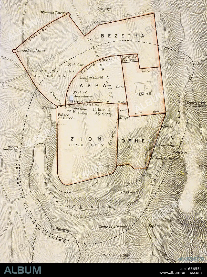
City map of ancient Jerusalem From The Citizen's Atlas of the World published London circa 1899.
| Partager |
|---|
 Pinterest Pinterest |
 Twitter Twitter |
 Facebook Facebook |
 Copier le lien Copier le lien |
 Email Email |
|
Ajouter à une autre Lightbox |
|
Ajouter à une autre Lightbox |


Avez-vous déjà un compte? S'identifier
Vous n'avez pas de compte ? S'inscrire
Acheter cette image

Légende:
Voir la traduction automatique
City map of ancient Jerusalem From The Citizen's Atlas of the World published London circa 1899
Crédit:
Album / Universal History Archive/Universal Images Group
Autorisations:
Modèle: Non - Propriété: Non
Questions sur les droits?
Questions sur les droits?
Taille de l'image:
3822 x 4843 px | 53.0 MB
Taille d'impression:
32.4 x 41.0 cm | 12.7 x 16.1 in (300 dpi)
Mots clés:
ANCIEN • ANTIQUE • BIBLIQUE • CARTE (GEOGRAPHIE) • CARTE GEOGRAPHIQUE • CARTE • CITE • COULEUR • DESSIN PLANS • JERUSALEM • JERUSALEM, (IL) VUE SUR • JERUSALEM, (IL) • JERUSALEM, VUE • KEN • PAYSAGE: JERUSALEM • PLAN (CARTOGRAPHIE) • PLAN • PLANS • VERTICALE • VILE • VILLE • VUE JERUSALEM, (IL) • XIXE SIÈCLE
