alb1653949
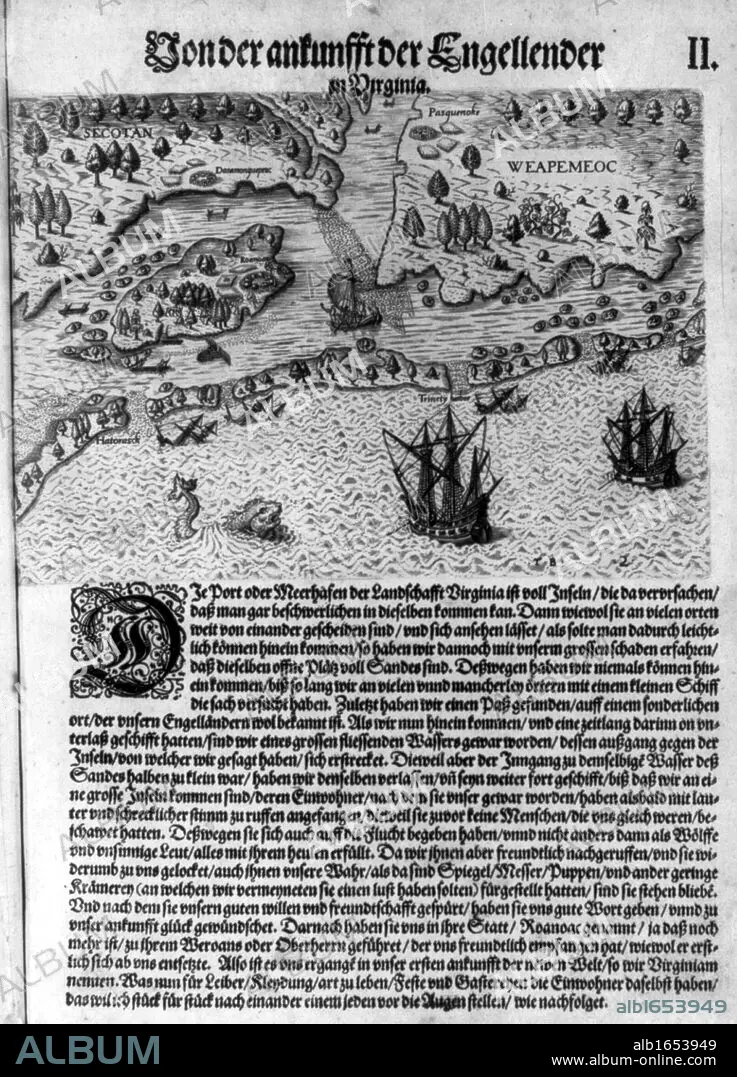
The Colony of Virginia depicted in a book with Map. 17th Century.
| Partager |
|---|
 Pinterest Pinterest |
 Twitter Twitter |
 Facebook Facebook |
 Copier le lien Copier le lien |
 Email Email |
|
Ajouter à une autre Lightbox |
|
Ajouter à une autre Lightbox |


Avez-vous déjà un compte? S'identifier
Vous n'avez pas de compte ? S'inscrire
Acheter cette image

Légende:
Voir la traduction automatique
The Colony of Virginia depicted in a book with Map. 17th Century.
Crédit:
Album / Universal History Archive/Universal Images Group
Autorisations:
Modèle: Non - Propriété: Non
Questions sur les droits?
Questions sur les droits?
Taille de l'image:
2550 x 3541 px | 25.8 MB
Taille d'impression:
21.6 x 30.0 cm | 8.5 x 11.8 in (300 dpi)
Mots clés:
