alb4055419
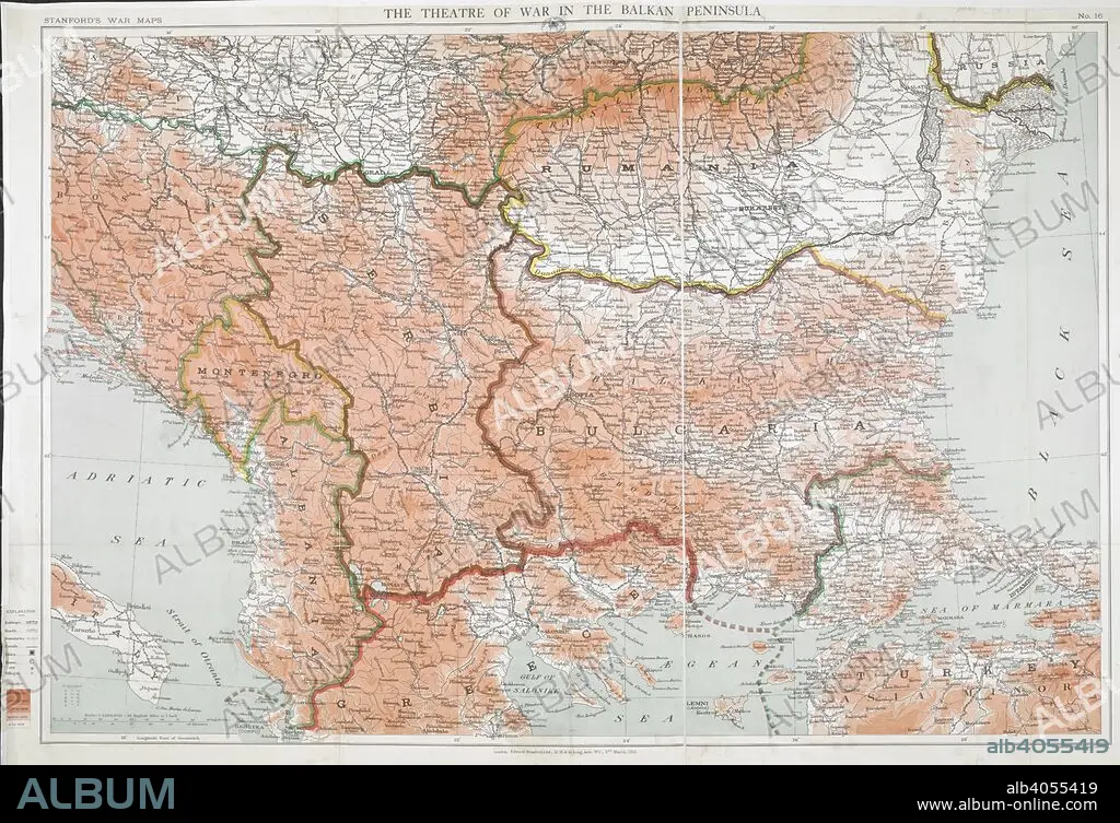
First World War map of the Balkan peninsula, 1916. Stanford's War Maps. No. 14. The Seat of War in the Balkan peninsula. Scale, 1 : 1,140,000 = 18 English miles to 1 inch. 9 March 1916. Source: Maps.1035.(90) no.16.
| Partager |
|---|
 Pinterest Pinterest |
 Twitter Twitter |
 Facebook Facebook |
 Copier le lien Copier le lien |
 Email Email |
|
Ajouter à une autre Lightbox |
|
Ajouter à une autre Lightbox |


Avez-vous déjà un compte? S'identifier
Vous n'avez pas de compte ? S'inscrire
Acheter cette image.
Sélectionnez l'usage:

Légende:
Voir la traduction automatique
First World War map of the Balkan peninsula, 1916. Stanford's War Maps. No. 14. The Seat of War in the Balkan peninsula. Scale, 1 : 1,140,000 = 18 English miles to 1 inch. 9 March 1916. Source: Maps.1035.(90) no.16.
Crédit:
Album / British Library
Autorisations:
Taille de l'image:
8481 x 5800 px | 140.7 MB
Taille d'impression:
71.8 x 49.1 cm | 28.3 x 19.3 in (300 dpi)
Mots clés:
BALKA • BALKAN • CARTE (GEOGRAPHIE) • CARTE GEOGRAPHIQUE • CARTE • CARTOGRAPHIE • DESSIN PLANS • EUROPE • ÉVÉNEMENT • GRANDE GUERRE • GUERRE 14-18 • GUERRE 1914-1918 • GUERRE MONDIALE I • GUERRE • PLAN (CARTOGRAPHIE) • PLANS • PREMIERE GUERRE MONDIALE (1914-1918) • PREMIERE GUERRE MONDIALE • SCIENCE: CARTOGRAPHIE • XXE SIECLE
