alb9433967
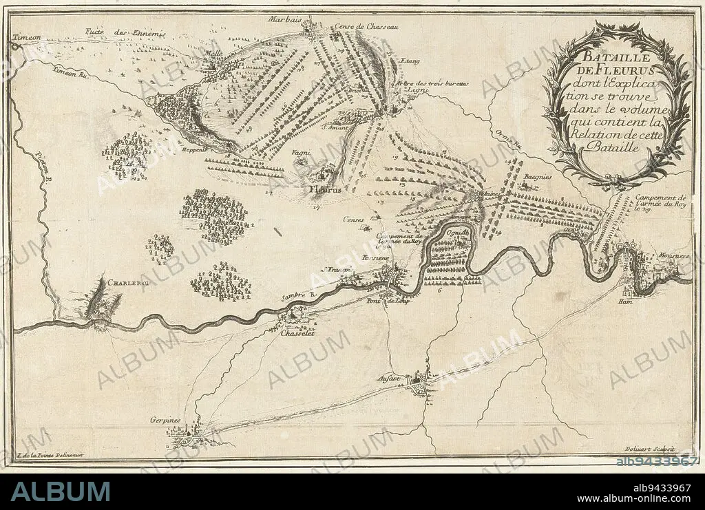
Map of the Fleurus area near Charleroi showing the positions of the armies at the battle of Fleurus, a victory of the French under the Duke of Luxembourg over the Allied army under the Prince of Waldeck, 1 July 1690, Battle of Fleurus, 1690 Bataille de Fleurus , print maker: Juan Dolívar, (mentioned on object), intermediary draughtsman: François de La Pointe, (mentioned on object), France, 1690, paper, etching, h 243 mm × w 370 mm.
| Partager |
|---|
 Pinterest Pinterest |
 Twitter Twitter |
 Facebook Facebook |
 Copier le lien Copier le lien |
 Email Email |
|
Ajouter à une autre Lightbox |
|
Ajouter à une autre Lightbox |


Avez-vous déjà un compte? S'identifier
Vous n'avez pas de compte ? S'inscrire
Acheter cette image.
Sélectionnez l'usage:

Légende:
Voir la traduction automatique
Map of the Fleurus area near Charleroi showing the positions of the armies at the battle of Fleurus, a victory of the French under the Duke of Luxembourg over the Allied army under the Prince of Waldeck, 1 July 1690, Battle of Fleurus, 1690 Bataille de Fleurus , print maker: Juan Dolívar, (mentioned on object), intermediary draughtsman: François de La Pointe, (mentioned on object), France, 1690, paper, etching, h 243 mm × w 370 mm
Personnalités:
Crédit:
Album / quintlox
Autorisations:
Modèle: Non - Propriété: Non
Questions sur les droits?
Questions sur les droits?
Taille de l'image:
5590 x 3754 px | 60.0 MB
Taille d'impression:
47.3 x 31.8 cm | 18.6 x 12.5 in (300 dpi)
Mots clés:
ARMEE • ARMÉEE • ARMÉES • BATAILLE • BATALLE • CARTE (GEOGRAPHIE) • CARTE GEOGRAPHIQUE • CARTE • DESSIN PLANS • DUC • FRANCE • JUAN DOLIVAR • LUXEMBOURG • OBJET • PAPIER • PLAN (CARTOGRAPHIE) • PLANS • PRICE • PRINCE • PRINCES
