alb4466651
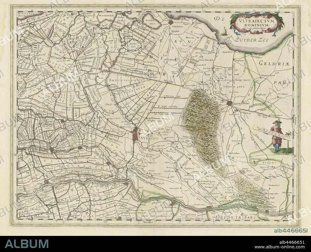
Map of the province of Utrecht, Vltraiectvm Dominivm (title on object), Map of the province of Utrecht on a scale of 1: 150 000 with the north on the right. Top right a cartouche with the title. Right: a standing surveyor with a distance bar in his hand that indicates a scale in Dutch miles, maps of separate countries or regions, Eemland, Willem Janszoon Blaeu (mentioned on object), 1630, paper, engraving, h 387 mm × w 505 mm.
| Partager |
|---|
 Pinterest Pinterest |
 Twitter Twitter |
 Facebook Facebook |
 Copier le lien Copier le lien |
 Email Email |
|
Ajouter à une autre Lightbox |
|
Ajouter à une autre Lightbox |


Avez-vous déjà un compte? S'identifier
Vous n'avez pas de compte ? S'inscrire
Acheter cette image

Légende:
Voir la traduction automatique
Map of the province of Utrecht, Vltraiectvm Dominivm (title on object), Map of the province of Utrecht on a scale of 1: 150 000 with the north on the right. Top right a cartouche with the title. Right: a standing surveyor with a distance bar in his hand that indicates a scale in Dutch miles, maps of separate countries or regions, Eemland, Willem Janszoon Blaeu (mentioned on object), 1630, paper, engraving, h 387 mm × w 505 mm
Crédit:
Album / quintlox
Autorisations:
Modèle: Non - Propriété: Non
Questions sur les droits?
Questions sur les droits?
Taille de l'image:
5023 x 3808 px | 54.7 MB
Taille d'impression:
42.5 x 32.2 cm | 16.7 x 12.7 in (300 dpi)
Mots clés:
CARTE (GEOGRAPHIE) • CARTE GEOGRAPHIQUE • CARTE • CORPS MAINS • DESSIN PLANS • FRAVURE • GRAVURE • MAIN • MAINS • NORD • OBJET • PAPIER • PLAN (CARTOGRAPHIE) • PLANS • PROVINCE • PROVINS • REGIONS
