alb8361738
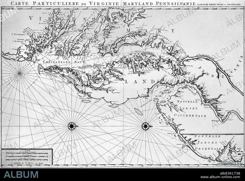
Map of Maryland colony
| Partager |
|---|
 Pinterest Pinterest |
 Twitter Twitter |
 Facebook Facebook |
 Copier le lien Copier le lien |
 Email Email |
|
Ajouter à une autre Lightbox |
|
Ajouter à une autre Lightbox |


Avez-vous déjà un compte? S'identifier
Vous n'avez pas de compte ? S'inscrire
Acheter cette image.
Sélectionnez l'usage:

Légende: Voir la traduction automatique
Map of Maryland colony
Map of Maryland colony
Crédit: Album / Universal Images Group / Encyclopaedia Britannica
Autorisations: ? Autorisation de modèle: Non - ? Autorisation de propriété: Non
Questions sur les droits?
Questions sur les droits?
Taille de l'image: 2607 × 1786 px | 13.3 MB
Taille d'impression: 22.1 × 15.1 cm | 1026.4 × 703.1 in (300 dpi)
Mots clés: 17E SIECLE • 17EME S • AMERICAIN (ETATS-UNIS) • AMERICAIN (USA) • AMERIQUE • AMERIQUE, CONTINENT • CARTE (GEOGRAPHIE) • CARTE GEOGRAPHIQUE • CARTE • CARTOGRAPHIE • COLONIALISME • COLONIE • CONTINENT AMERIQUE • DESSIN PLANS • DIX-SEPTIÈME SIÈCLE • ÉTAS UNIS • ÉTAS-UNIS • ETATS UNIS • ETATS-UNIS • HISOIRE • HISTOIRE • HORIZONTALE • ILLUSTRATION • PLAN (CARTOGRAPHIE) • PLANS • SCIENCE: CARTOGRAPHIE • U. S. A. • XVIIE SIECLE • ŽTATS-UNIS
