alb4058782
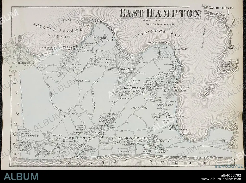
Map of East Hampton, on Long Island New York in the United States. . Atlas of Long Island, New York. From recent and actual Surveys and Records under the superintendence of F.W. Beers. New York, 1873. Source: Maps.33.d.17 f.192. Language: English.
| Partager |
|---|
 Pinterest Pinterest |
 Twitter Twitter |
 Facebook Facebook |
 Copier le lien Copier le lien |
 Email Email |
|
Ajouter à une autre Lightbox |
|
Ajouter à une autre Lightbox |


Avez-vous déjà un compte? S'identifier
Vous n'avez pas de compte ? S'inscrire
Acheter cette image.
Sélectionnez l'usage:

Légende:
Voir la traduction automatique
Map of East Hampton, on Long Island New York in the United States. . Atlas of Long Island, New York. From recent and actual Surveys and Records under the superintendence of F.W. Beers. New York, 1873. Source: Maps.33.d.17 f.192. Language: English.
Crédit:
Album / British Library
Autorisations:
Modèle: Non - Propriété: Non
Questions sur les droits?
Questions sur les droits?
Taille de l'image:
7010 x 4866 px | 97.6 MB
Taille d'impression:
59.4 x 41.2 cm | 23.4 x 16.2 in (300 dpi)
Mots clés:
AMERICAIN (ETATS-UNIS) • AMERICAIN (USA) • ARCHIPEL • CARTE (GEOGRAPHIE) • CARTE GEOGRAPHIQUE • CARTE • CARTOGRAPHIE • DESSIN PLANS • ÉTAS UNIS • ÉTAS-UNIS • ETATS UNIS • ETATS-UNIS • ILE • ÎLES • NEW YORK • NEW YORK, ETATS-UNIS • NEW-YORK • PLAN (CARTOGRAPHIE) • PLANS • SCIENCE: CARTOGRAPHIE • U. S. A. • XIXE SIÈCLE • ŽTATS-UNIS
