alb3123202
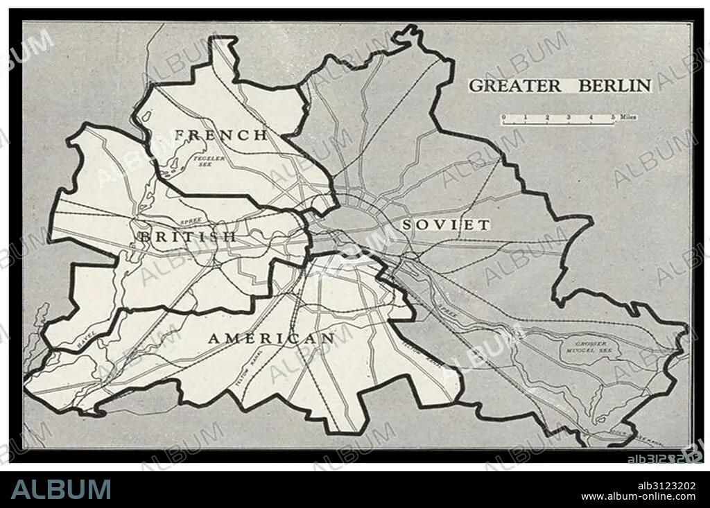
Berlin Blockade Map.
| Partager |
|---|
 Pinterest Pinterest |
 Twitter Twitter |
 Facebook Facebook |
 Copier le lien Copier le lien |
 Email Email |
|
Ajouter à une autre Lightbox |
|
Ajouter à une autre Lightbox |


Avez-vous déjà un compte? S'identifier
Vous n'avez pas de compte ? S'inscrire
Acheter cette image.
Sélectionnez l'usage:

Titre: Berlin Blockade Map.
Légende: Voir la traduction automatique
Berlin Blockade Map 1948. The Berlin Blockade (1 April 1948 – 12 May 1949) was one of the first major international crises of the Cold War. During the multinational occupation of post–World War II Germany, the Soviet Union blocked the Western Allies' railway, road, and canal access to the sectors of Berlin under Western control.
Berlin Blockade Map 1948. The Berlin Blockade (1 April 1948 – 12 May 1949) was one of the first major international crises of the Cold War. During the multinational occupation of post–World War II Germany, the Soviet Union blocked the Western Allies' railway, road, and canal access to the sectors of Berlin under Western control.
Crédit: Album / Universal Images Group / Universal History Archive
Autorisations: ? Autorisation de modèle: Non - ? Autorisation de propriété: Non
Questions sur les droits?
Questions sur les droits?
Taille de l'image: 5100 × 3386 px | 49.4 MB
Taille d'impression: 43.2 × 28.7 cm | 2007.9 × 1333.1 in (300 dpi)
Mots clés: 1939-1945 • ALLEMAGNE • BERLIN • CARTE (GEOGRAPHIE) • CARTE GEOGRAPHIQUE • CARTE • COMMUNISME: UNION SOVIETIQ • CRISE • DESSIN PLANS • DEUXIEME GUERRE MONDIALE • GUERRE FROIDE • GUERRE MONDIALE II • GUERRE • OCCIDENTAL • OCCIDENTAUX • OCCUPATION • PLAN (CARTOGRAPHIE) • PLANS • SECONDE GUERRE MONDIALE • WESTERN • XXE SIECLE
