alb4951483
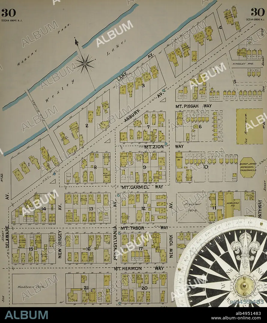
Image 31 of Sanborn Fire Insurance Map from New Jersey Coast, New Jersey Coast, New Jersey. 1890 Vol. 4. 42 Sheet(s). Includes Anglesea, Avalon, Cape May, Cape May Point, Holly Beach City, Mount Vernon, New Mount Vernon, Ocean City, Sea Isle City, Shellingers Landing, West Cape May, Wildwood Beach. Bound, America, street map with a Nineteenth Century compass.
| Partager |
|---|
 Pinterest Pinterest |
 Twitter Twitter |
 Facebook Facebook |
 Copier le lien Copier le lien |
 Email Email |
|
Ajouter à une autre Lightbox |
|
Ajouter à une autre Lightbox |


Avez-vous déjà un compte? S'identifier
Vous n'avez pas de compte ? S'inscrire
Acheter cette image

Légende:
Voir la traduction automatique
Image 31 of Sanborn Fire Insurance Map from New Jersey Coast, New Jersey Coast, New Jersey. 1890 Vol. 4. 42 Sheet(s). Includes Anglesea, Avalon, Cape May, Cape May Point, Holly Beach City, Mount Vernon, New Mount Vernon, Ocean City, Sea Isle City, Shellingers Landing, West Cape May, Wildwood Beach. Bound, America, street map with a Nineteenth Century compass
Crédit:
Album / quintlox
Autorisations:
Modèle: Non - Propriété: Non
Questions sur les droits?
Questions sur les droits?
Taille de l'image:
5000 x 5761 px | 82.4 MB
Taille d'impression:
42.3 x 48.8 cm | 16.7 x 19.2 in (300 dpi)
Mots clés:
AMERICAIN (ETATS-UNIS) • AMERICAIN (USA) • AMERIQUE • AMERIQUE, CONTINENT • CARTE • CARTOGRAPHIE • CITE • CONTINENT AMERIQUE • DEHORS • EN PLEINE NATURE • ÉTAS UNIS • ÉTAS-UNIS • ETATS UNIS • ETATS-UNIS • GEOGRAPHIE • MILLESIME • RUE • SCIENCE: CARTOGRAPHIE • TRANSPORT VOYAGE • TRAVERSÉE • U. S. A. • VILE • VILLE • VOYAGE • ŽTATS-UNIS
