alb4064644
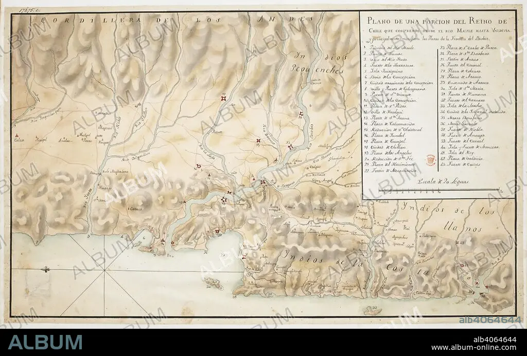
Map of Concepcion and surrounding area, in Chile, orientated with East at the top, with scale, three and a half leagues to an inch, and a key. Plano de una Porcion del Reino de Chile. 18th century. Source: Add. 17675 E. Language: Spanish.
| Partager |
|---|
 Pinterest Pinterest |
 Twitter Twitter |
 Facebook Facebook |
 Copier le lien Copier le lien |
 Email Email |
|
Ajouter à une autre Lightbox |
|
Ajouter à une autre Lightbox |


Avez-vous déjà un compte? S'identifier
Vous n'avez pas de compte ? S'inscrire
Acheter cette image.
Sélectionnez l'usage:

Légende: Voir la traduction automatique
Map of Concepcion and surrounding area, in Chile, orientated with East at the top, with scale, three and a half leagues to an inch, and a key. Plano de una Porcion del Reino de Chile. 18th century. Source: Add. 17675 E. Language: Spanish.
Map of Concepcion and surrounding area, in Chile, orientated with East at the top, with scale, three and a half leagues to an inch, and a key. Plano de una Porcion del Reino de Chile. 18th century. Source: Add. 17675 E. Language: Spanish.
Crédit: Album / British Library
Autorisations: ? Autorisation de modèle: Non - ? Autorisation de propriété: Non
Questions sur les droits?
Questions sur les droits?
Taille de l'image: 8858 × 5538 px | 140.3 MB
Taille d'impression: 75.0 × 46.9 cm | 3487.4 × 2180.3 in (300 dpi)
