alb3840178
Earthquake Zones Map
| Partager |
|---|
 Pinterest Pinterest |
 Twitter Twitter |
 Facebook Facebook |
 Copier le lien Copier le lien |
 Email Email |
|
Ajouter à une autre Lightbox |
|
Ajouter à une autre Lightbox |


Avez-vous déjà un compte? S'identifier
Vous n'avez pas de compte ? S'inscrire
Acheter cette image.
Sélectionnez l'usage:

Titre: Earthquake Zones Map
Légende: Voir la traduction automatique
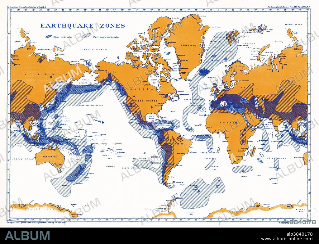
A map showing earthquake zones. This world seismicity map clearly shows the correlation of the Pacific Ring of Fire with earthquake epicentres, the Alpine-Himalayan Belt, and the coincidence of major portions of the mid-ocean ridge system with areas of seismicity.
A map showing earthquake zones. This world seismicity map clearly shows the correlation of the Pacific Ring of Fire with earthquake epicentres, the Alpine-Himalayan Belt, and the coincidence of major portions of the mid-ocean ridge system with areas of seismicity.
Crédit: Album / Science Source / National Oceanic and Atmospheric Administration
Autorisations: ? Autorisation de modèle: Non - ? Autorisation de propriété: Non
Questions sur les droits?
Questions sur les droits?
Taille de l'image: 5140 × 3680 px | 54.1 MB
Taille d'impression: 43.5 × 31.2 cm | 2023.6 × 1448.8 in (300 dpi)
Mots clés: ALPIN • FEU • GEOLOGIE • GRAPHIQUE • ILLUSTRATION • MER • MONDE • OCEAN • PAYSAGE MARITIME • QUATRE ELEMENTS: FEU • SEISME • TREMBLEMENT DE TERRE
