alb3800902
WWI, Satirical War Map of Europe, 1914
| Partager |
|---|
 Pinterest Pinterest |
 Twitter Twitter |
 Facebook Facebook |
 Copier le lien Copier le lien |
 Email Email |
|
Ajouter à une autre Lightbox |
|
Ajouter à une autre Lightbox |


Avez-vous déjà un compte? S'identifier
Vous n'avez pas de compte ? S'inscrire
Acheter cette image.
Sélectionnez l'usage:

Titre: WWI, Satirical War Map of Europe, 1914
Légende: Voir la traduction automatique
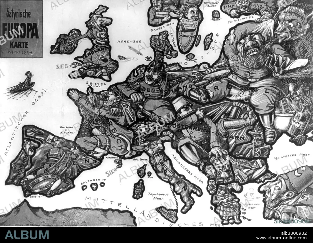
Entitled: Satyrische Europa Karte Weltkrieg 1914. Sketch depicting a map of Europe at the outbreak of the first World War with each country depicted as a human figure representative of the particular state of affairs or attitudes of the country, for instance, Germany is depicted as a soldier fighting with both Russia and France, while eyeing England.
Entitled: Satyrische Europa Karte Weltkrieg 1914. Sketch depicting a map of Europe at the outbreak of the first World War with each country depicted as a human figure representative of the particular state of affairs or attitudes of the country, for instance, Germany is depicted as a soldier fighting with both Russia and France, while eyeing England.
Crédit: Album / LOC/Science Source
Autorisations: ? Autorisation de modèle: Non - ? Autorisation de propriété: Non
Questions sur les droits?
Questions sur les droits?
Taille de l'image: 4800 × 3475 px | 47.7 MB
Taille d'impression: 40.6 × 29.4 cm | 1889.8 × 1368.1 in (300 dpi)
Mots clés: ANGLETERRE • CÉLÈBRE • CELEBRITE • ECOSSE • ESPAGNE • ÉVÉNEMENT • FRONT DE L'OUEST • GRANDE GUERRE • GUERRE 14-18 • GUERRE 1914-1918 • GUERRE MONDIALE I • HOMME • ILLUSTRATION • IRELANDE • IRLANDE • ITALIE • PREMIERE GUERRE MONDIALE (1914-1918) • PREMIERE GUERRE MONDIALE • RUSSIE • SUEDE • XXE SIECLE
