alb2957539
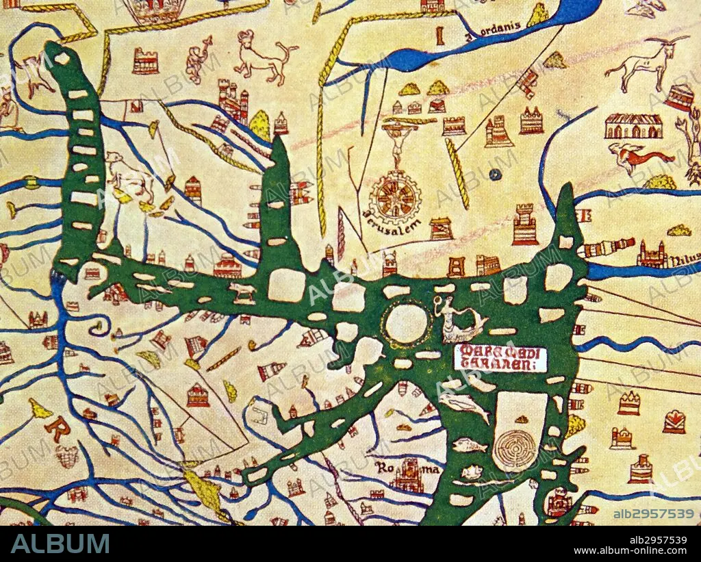
The Hereford Mappa Mundi of 1280.
| Partager |
|---|
 Pinterest Pinterest |
 Twitter Twitter |
 Facebook Facebook |
 Copier le lien Copier le lien |
 Email Email |
|
Ajouter à une autre Lightbox |
|
Ajouter à une autre Lightbox |


Avez-vous déjà un compte? S'identifier
Vous n'avez pas de compte ? S'inscrire
Acheter cette image.
Sélectionnez l'usage:

Titre:
The Hereford Mappa Mundi of 1280.
Légende:
Voir la traduction automatique
detail showing Jerusalem as the centre of the world on the Hereford Mappa Mundi of 1280.
Crédit:
Album / Universal Images Group / Universal History Archive \ UIG
Autorisations:
Taille de l'image:
5100 x 3825 px | 55.8 MB
Taille d'impression:
43.2 x 32.4 cm | 17.0 x 12.7 in (300 dpi)
Mots clés:
ANGALIS • ANGLAIS • ANGLAISE • CARTE (GEOGRAPHIE) • CARTE GEOGRAPHIQUE • CARTE • CARTOGRAPHIE • DESSIN PLANS • EXPLORATION • JERUSALEM • JERUSALEM, (IL) VUE SUR • JERUSALEM, (IL) • JERUSALEM, VUE • MAPPEMONDE • PAYSAGE: JERUSALEM • PLAN (CARTOGRAPHIE) • PLANISPHERE • PLANS • SCIENCE: CARTOGRAPHIE • VUE JERUSALEM, (IL)
