alb9661383
Map of India, 1857. Creator: Unknown.
| Partager |
|---|
 Pinterest Pinterest |
 Twitter Twitter |
 Facebook Facebook |
 Copier le lien Copier le lien |
 Email Email |
|
Ajouter à une autre Lightbox |
|
Ajouter à une autre Lightbox |


Avez-vous déjà un compte? S'identifier
Vous n'avez pas de compte ? S'inscrire
Acheter cette image

Titre:
Map of India, 1857. Creator: Unknown.
Légende:
Voir la traduction automatique
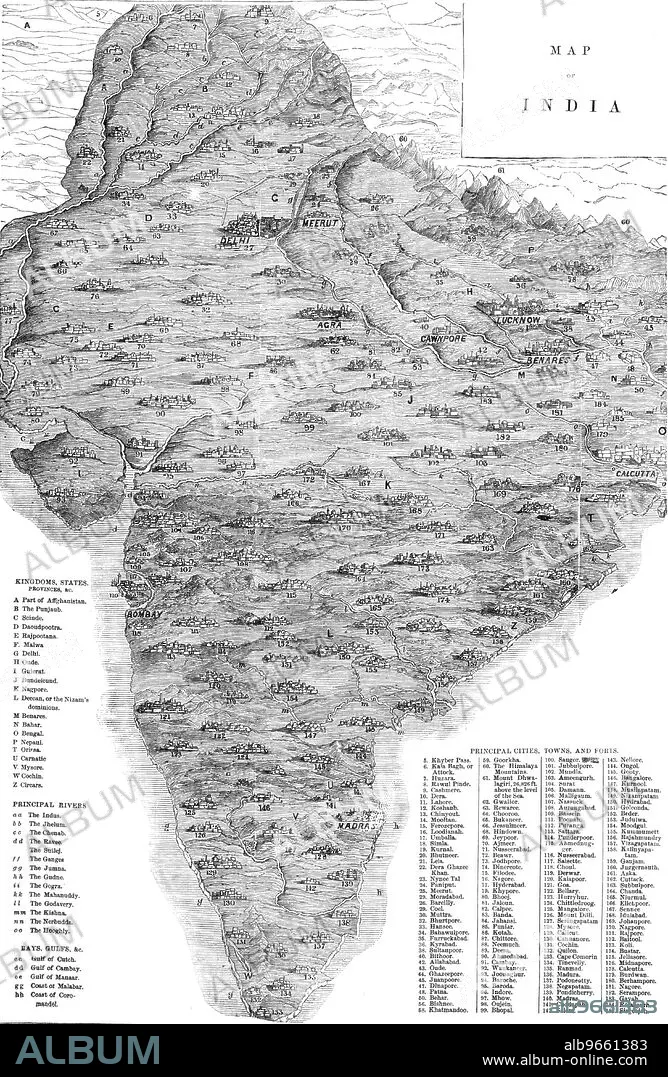
Map of India, 1857. Map of the Indian subcontinent during the British colonial period, showing 'Kingdoms, States, Provinces &c...Principal Rivers...Bays, Gulfs &c...Principal Cities, Towns, and Forts'. From "Illustrated London News", 1857.
Personnalités:
Crédit:
Album / The Print Collector/Heritage Images
Autorisations:
Modèle: Non - Propriété: Non
Questions sur les droits?
Questions sur les droits?
Taille de l'image:
3755 x 5758 px | 61.9 MB
Taille d'impression:
31.8 x 48.8 cm | 12.5 x 19.2 in (300 dpi)
Mots clés:
ASIE • ASIE, CONTINENT • BENARES • CALCUTTA • CHENNAI • COLONIALISME • CONTINENT ASIE • CÔTE • COULEUR • DELHI • GEOGRAPHIE • IMPERIALISME • INDE BRITANNIQUE • INDES BRITANNIQUES • JOURNAL • LITTORAL • MADRAS • MARITIME • NOIR ET BLANC • TAMIL NADU • XIXE SIÈCLE
