alb1468479
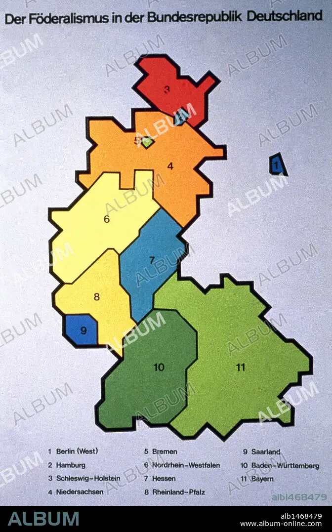
History of Germany (1949-1990). Map of the Federal Republic of Germany. Lander.
| Partager |
|---|
 Pinterest Pinterest |
 Twitter Twitter |
 Facebook Facebook |
 Copier le lien Copier le lien |
 Email Email |
|
Ajouter à une autre Lightbox |
|
Ajouter à une autre Lightbox |


Avez-vous déjà un compte? S'identifier
Vous n'avez pas de compte ? S'inscrire
Acheter cette image.
Sélectionnez l'usage:

Légende: Voir la traduction automatique
History of Germany (1949-1990). Map of the Federal Republic of Germany. Lander.
History of Germany (1949-1990). Map of the Federal Republic of Germany. Lander.
Crédit: Album / Prisma
Autorisations: ? Autorisation de modèle: Non - ? Autorisation de propriété: Non
Questions sur les droits?
Questions sur les droits?
Taille de l'image: 2939 × 4480 px | 37.7 MB
Taille d'impression: 24.9 × 37.9 cm | 1157.1 × 1763.8 in (300 dpi)
Mots clés: ALLEMAGNE • ALLEMAND • ALLEMANDE • BAVARIA • BAVIÈRE • BLEU • CARTE (GEOGRAPHIE) • CARTE GEOGRAPHIQUE • CARTE • CARTOGRAPHIE • COULEUR • COULEURS • DESSIN PLANS • EUROPE • FEDERALISME • HAMBOURG • HISOIRE • HISTOIRE • JAUNE • ORANGE • PLAN (CARTOGRAPHIE) • PLANS • ROUGE • SCIENCE: CARTOGRAPHIE • VERT
