alb4057952
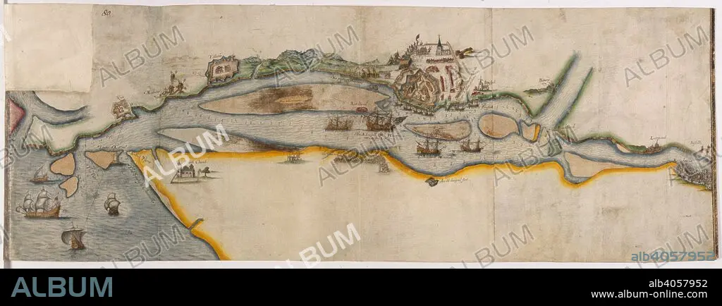
Map representing the course of the river Garonne from Bordeaux to the sea, with the town of Blaye besieged. 1593. Source: Cotton Augustus I.ii.80.
| Partager |
|---|
 Pinterest Pinterest |
 Twitter Twitter |
 Facebook Facebook |
 Copier le lien Copier le lien |
 Email Email |
|
Ajouter à une autre Lightbox |
|
Ajouter à une autre Lightbox |


Avez-vous déjà un compte? S'identifier
Vous n'avez pas de compte ? S'inscrire
Acheter cette image.
Sélectionnez l'usage:

Légende:
Voir la traduction automatique
Map representing the course of the river Garonne from Bordeaux to the sea, with the town of Blaye besieged. 1593. Source: Cotton Augustus I.ii.80.
Crédit:
Album / British Library
Autorisations:
Modèle: Non - Propriété: Non
Questions sur les droits?
Questions sur les droits?
Taille de l'image:
7932 x 2948 px | 66.9 MB
Taille d'impression:
67.2 x 25.0 cm | 26.4 x 9.8 in (300 dpi)
Mots clés:
16E SIECLE • 16EME S • BATAILLE • BATALLE • CARTE (GEOGRAPHIE) • CARTE GEOGRAPHIQUE • CARTE • CARTOGRAPHIE • DESSIN PLANS • FLEUVE • FRANCE • PLAN (CARTOGRAPHIE) • PLANS • RIO • RIVIÈRE FLEUVE • RIVIERE • RIVIRE • RIVIRE • SCIENCE: CARTOGRAPHIE • SEIZIÈME SIÈCLE • TRANSPORT • XVIE SIECLE
