alb5531863
Hua Yi tu, map of China.
| Partager |
|---|
 Pinterest Pinterest |
 Twitter Twitter |
 Facebook Facebook |
 Copier le lien Copier le lien |
 Email Email |
|
Ajouter à une autre Lightbox |
|
Ajouter à une autre Lightbox |


Avez-vous déjà un compte? S'identifier
Vous n'avez pas de compte ? S'inscrire
Acheter cette image.
Sélectionnez l'usage:

Titre:
Hua Yi tu, map of China.
Légende:
Voir la traduction automatique
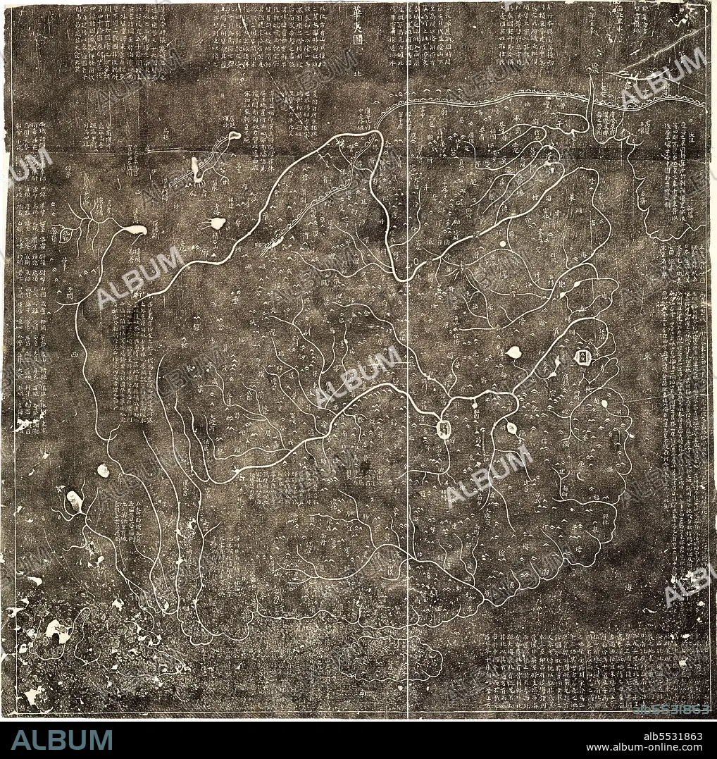
Hua Yi tu, map of China. Covers China in Nan Song Dynasty, from east to the sea, including Korea to the west of Pamier area, from north to the Great Wall, northeast to Heilongjiang region, to the south of Hainan Island. Shows mountains, rivers, lakes, and more than 400 administrative place names of China.
Crédit:
Album / Universal Images Group / World History Archive / UIG
Autorisations:
Modèle: Non - Propriété: Non
Questions sur les droits?
Questions sur les droits?
Taille de l'image:
4567 x 4592 px | 60.0 MB
Taille d'impression:
38.7 x 38.9 cm | 15.2 x 15.3 in (300 dpi)
Mots clés:
ASIE • ASIE, CONTINENT • CARTE (GEOGRAPHIE) • CARTE GEOGRAPHIQUE • CARTE • CHAINE DE MONTAGNES • CHINE • CONTINENT ASIE • CORDILLÈRE • COREE • DESSIN PLANS • EAU LAC • FLEUVE • LAC • LACS • MASSIF • MER • OCEAN • PAYSAGE MARITIME • PLAN (CARTOGRAPHIE) • PLANS • RIO • RIVIÈRE FLEUVE • RIVIERE • RIVIRE • RIVIRE • XXE SIECLE
