alb4068721
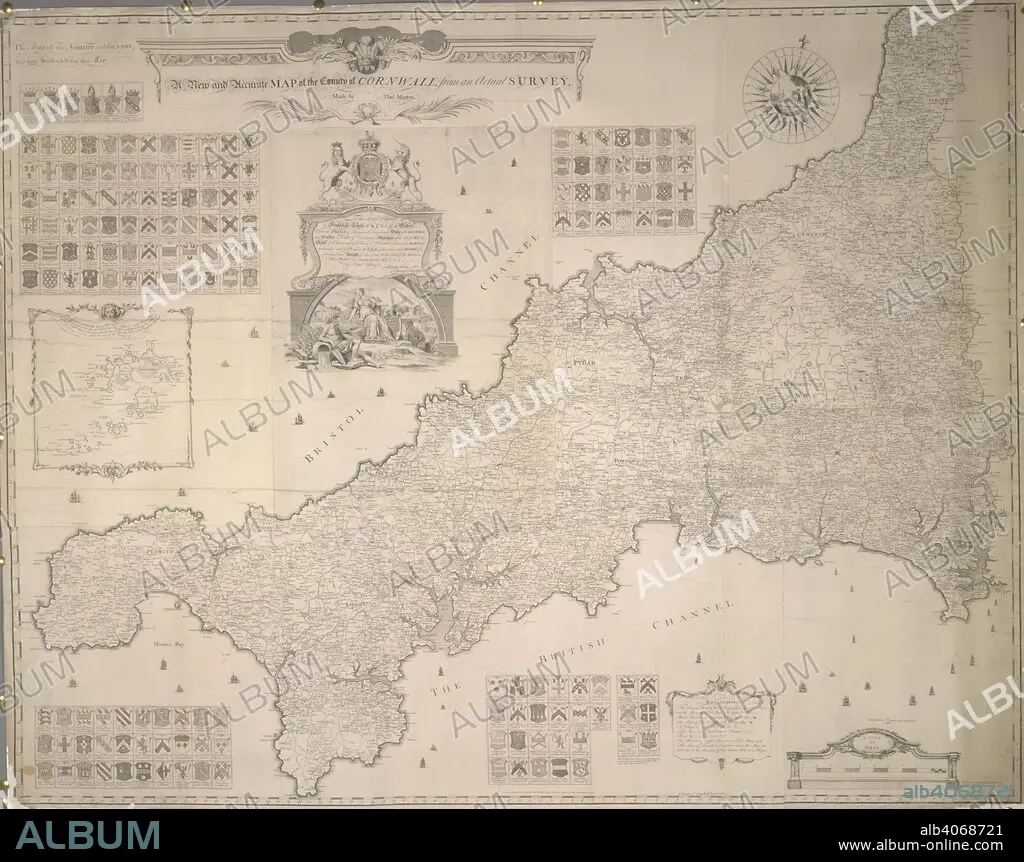
A map of the County of Cornwall. A new and accurate Map of the County of Cornwall, from an actual Survey made by Thos. Martyn, etc. (The Islands of Scilly). Feb., 1748/1749. Source: Maps K.Top.9.28.(1.). Language: English.
| Partager |
|---|
 Pinterest Pinterest |
 Twitter Twitter |
 Facebook Facebook |
 Copier le lien Copier le lien |
 Email Email |
|
Ajouter à une autre Lightbox |
|
Ajouter à une autre Lightbox |


Avez-vous déjà un compte? S'identifier
Vous n'avez pas de compte ? S'inscrire
Acheter cette image

Légende:
Voir la traduction automatique
A map of the County of Cornwall. A new and accurate Map of the County of Cornwall, from an actual Survey made by Thos. Martyn, etc. (The Islands of Scilly). Feb., 1748/1749. Source: Maps K.Top.9.28.(1.). Language: English.
Crédit:
Album / British Library
Autorisations:
Modèle: Non - Propriété: Non
Questions sur les droits?
Questions sur les droits?
Taille de l'image:
4875 x 3852 px | 53.7 MB
Taille d'impression:
41.3 x 32.6 cm | 16.2 x 12.8 in (300 dpi)
Mots clés:
18 18E 18EME XVIII XVIIIE XVIIIEME SIECLE • 18E SIECLE • 18EME S • ANGLETARRE • ANGLETERE • ANGLETERRE • ARMOIRIES (NOBLESSE) • CARTE (GEOGRAPHIE) • CARTE GEOGRAPHIQUE • CARTE • CARTOGRAPHIE • DESSIN PLANS • DIX-HUITIÈME SIÈCLE • GRANDE BERTAGNE • GRANDE BRETAGNE • GRANDE-BRETAGNE • INGLATERRA • PLAN (CARTOGRAPHIE) • PLANS • ROYAUME UNI • ROYAUME-UNI • SCIENCE: CARTOGRAPHIE • XVIIIE SIECLE
