alb1650398
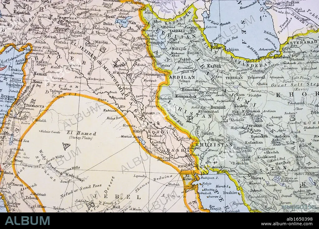
Partial map of Turkey Kurdistan Iraq Persia Middle East in 1890s From The Citizen's Atlas of the World published London circa 1899.
| Partager |
|---|
 Pinterest Pinterest |
 Twitter Twitter |
 Facebook Facebook |
 Copier le lien Copier le lien |
 Email Email |
|
Ajouter à une autre Lightbox |
|
Ajouter à une autre Lightbox |


Avez-vous déjà un compte? S'identifier
Vous n'avez pas de compte ? S'inscrire
Acheter cette image.
Sélectionnez l'usage:

Légende:
Voir la traduction automatique
Partial map of Turkey Kurdistan Iraq Persia Middle East in 1890s From The Citizen's Atlas of the World published London circa 1899
Crédit:
Album / Universal History Archive/Universal Images Group
Autorisations:
Taille de l'image:
5457 x 3638 px | 56.8 MB
Taille d'impression:
46.2 x 30.8 cm | 18.2 x 12.1 in (300 dpi)
Mots clés:
ANT. OR.: IRAK • ANT. OR.: IRAN • ART PERSAN • CARTE (GEOGRAPHIE) • CARTE GEOGRAPHIQUE • CARTE • COULEUR • DESSIN PLANS • EST • HORIZONTALE • IRAK • IRAK, ANT. OR. • IRAN • IRAN, ANT. OR. • KEN • MYTHES: PERSES • ORIENT • PERSAN • PERSE • PERSES • PERSES, MYTHES • PLAN (CARTOGRAPHIE) • PLANS • TURQUIE • XIXE SIÈCLE
