alb8371502
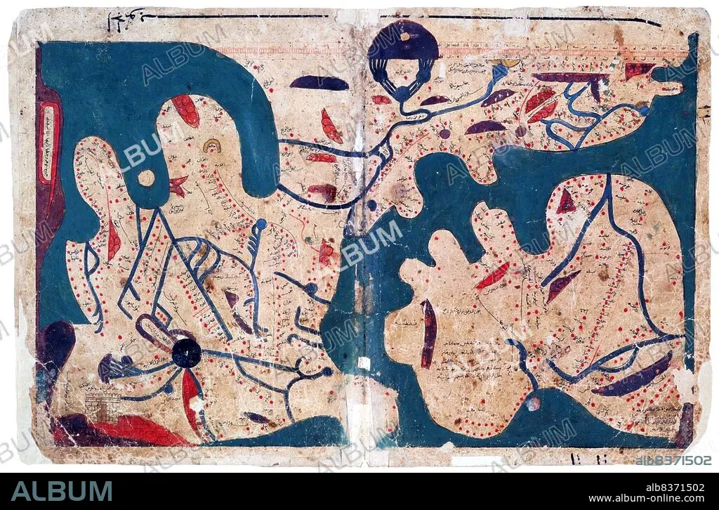
Egypt: Map of the world (south to the top), said to be the oldest rectangular map of the world, Kitab Ghara'ib al-funun wa-mulah al-'uyun< / i> ('The Book of Curiosities of the Sciences and Marvels for the Eyes'),12th-13th Centuries
| Partager |
|---|
 Pinterest Pinterest |
 Twitter Twitter |
 Facebook Facebook |
 Copier le lien Copier le lien |
 Email Email |
|
Ajouter à une autre Lightbox |
|
Ajouter à une autre Lightbox |


Avez-vous déjà un compte? S'identifier
Vous n'avez pas de compte ? S'inscrire
Acheter cette image

Titre:
Egypt: Map of the world (south to the top), said to be the oldest rectangular map of the world, Kitab Ghara'ib al-funun wa-mulah al-'uyun< / i> ('The Book of Curiosities of the Sciences and Marvels for the Eyes'),12th-13th Centuries
Légende:
Voir la traduction automatique
Composed in Egypt in the first half of the 11th century, the 'Book of Curiosities' is a 12th/13th century cosmographical manuscript contains highly unique celestial and terrestrial maps, including the first known rectangular map of the world produced before the renaissance.
. The geographical references are based largely on the first century work of Ptolemy but the manuscript contains previously unknown distinct cartographic features.
. The geographical references are based largely on the first century work of Ptolemy but the manuscript contains previously unknown distinct cartographic features.
Crédit:
Album / Universal Images Group / Pictures From History
Autorisations:
Modèle: Non - Propriété: Non
Questions sur les droits?
Questions sur les droits?
Taille de l'image:
5100 x 3351 px | 48.9 MB
Taille d'impression:
43.2 x 28.4 cm | 17.0 x 11.2 in (300 dpi)
Mots clés:
12E SIECLE • 12EME S • 13E SIECLE • 13EME S • ARABE • ARABIE • ART (CATÉGORIE) • ART • CARTE (GEOGRAPHIE) • CARTE GEOGRAPHIQUE • CARTE • CARTES • CARTOGRAPHIE • DESSIN PLANS • DOUZIÈME SIÈCLE • EGYPTE • ÉGYPTIEN • ÉGYPTIENNE • ISLAM • ISLMAM • MAPPEMONDE • MUSULMAN • MUSULMANE • MUSUSLMAN • PLAN (CARTOGRAPHIE) • PLANISPHERE • PLANS • PROCHE-ORIENT • SCIENCE • SCIENCE: CARTOGRAPHIE • SCIENCES • TREIZIÈME SIÈCLE • XIIE SIECLE • XIIIE SIECLE
