alb9839453
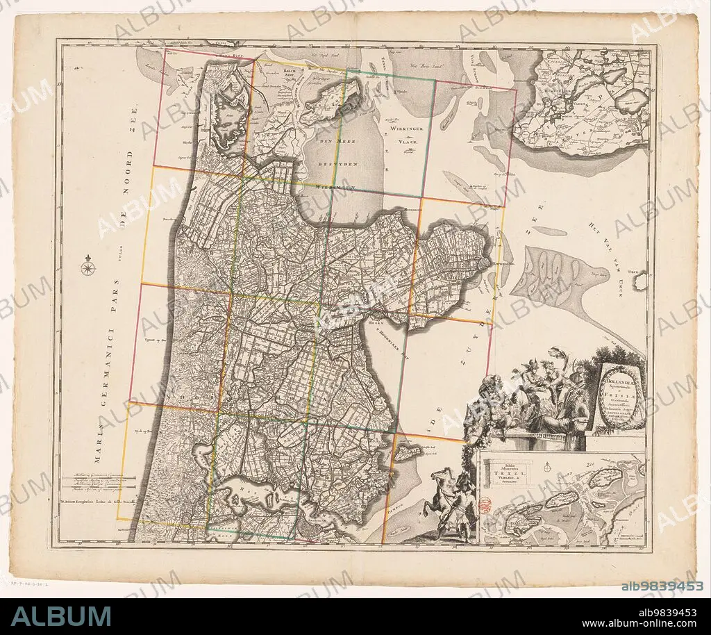
ANON. Map of Noord-Holland and part of Friesland, 1726-1750. Creator: Anon.
| Partager |
|---|
 Pinterest Pinterest |
 Twitter Twitter |
 Facebook Facebook |
 Copier le lien Copier le lien |
 Email Email |
|
Ajouter à une autre Lightbox |
|
Ajouter à une autre Lightbox |


Avez-vous déjà un compte? S'identifier
Vous n'avez pas de compte ? S'inscrire
Acheter cette image

Auteur:
Titre:
Map of Noord-Holland and part of Friesland, 1726-1750. Creator: Anon.
Légende:
Voir la traduction automatique
Map of Noord-Holland and part of Friesland, 1726-1750. At the bottom right the title cartouche with figures around it including a man with a horse, satyrs, putti, Mercury who takes the horn of plenty from a female figure, and a river god. Below that a deployment map of the Wadden area with scale.
Crédit:
Album / Heritage Art/Heritage Images
Autorisations:
Modèle: Non - Propriété: Non
Questions sur les droits?
Questions sur les droits?
Taille de l'image:
5914 x 4972 px | 84.1 MB
Taille d'impression:
50.1 x 42.1 cm | 19.7 x 16.6 in (300 dpi)
Mots clés:
18 18E 18EME XVIII XVIIIE XVIIIEME SIECLE • 18E SIECLE • 18EME S • ABONDANCE, CORNE D' • ANIMAL • ANIMAUX • ANON • ART, GALERIES • BONHOMME • CARTE • CARTOGRAPHIE • CHERUBIN • CHÉRUBINS • CORNE D'ABONDANCE • COULEUR • CRAYON A PAPIER • CRAYON • CRAYONS • DÉBALLAGE • DIX-HUITIÈME SIÈCLE • ECRITURE CRAYONS • EMPREINTE • GALERIE D'ART • GALLERIE DE PEINTURES • HOMME • ILLUSTRATION • NOIR ET BLANC • PARC DES EXPOSITIONS • PUTTO • RELIGION • SCENE • SCIENCE: CARTOGRAPHIE • XVIIIE SIECLE
